thumbnail.png
From the dataset abstract
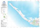
1:100 000 Reference maps for Bahamas showing islands, settlements, transport infrastructure, districts and topographic features
Source: Bahamas: Hurricane Matthew- Reference - Island Assessments
Additional Information
| Field | Value |
|---|---|
| Data last updated | October 24, 2016 |
| Metadata last updated | October 24, 2016 |
| Created | October 24, 2016 |
| Format | PNG |
| License | License not specified |
| Has views | True |
| Id | 50ea7d3c-a5db-4640-a738-5a8bef23aaf3 |
| On same domain | True |
| Package id | 855b7861-56b5-40aa-b1bd-d0f75efe1013 |
| Position | 2 |
| Revision id | c34f594f-ea9b-4517-9c6d-cafb8fb8d96e |
| State | active |
| Url type | upload |