thumbnail.png
From the dataset abstract
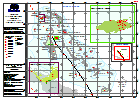
2010 Census Population for Supervisory Districts (represented as points). Data from Statoids derived from Bahamas Department of Statistics
Source: Bahamas: Hurricane Matthew - Baseline - Population 2010 Supervisory Districts
Additional Information
| Field | Value |
|---|---|
| Data last updated | October 7, 2016 |
| Metadata last updated | October 7, 2016 |
| Created | October 7, 2016 |
| Format | PNG |
| License | License not specified |
| Has views | True |
| Id | fd1e1aa2-9f14-4a66-b16d-d43c75504a39 |
| On same domain | True |
| Package id | 4d17292a-413c-4d53-b8c2-e2e9a2635790 |
| Position | 2 |
| Revision id | e5a49627-8bde-4c62-8c00-8df26a540332 |
| State | active |
| Url type | upload |