MA001-v01-bhs-country-overview-300dpi.jpg
From the dataset abstract
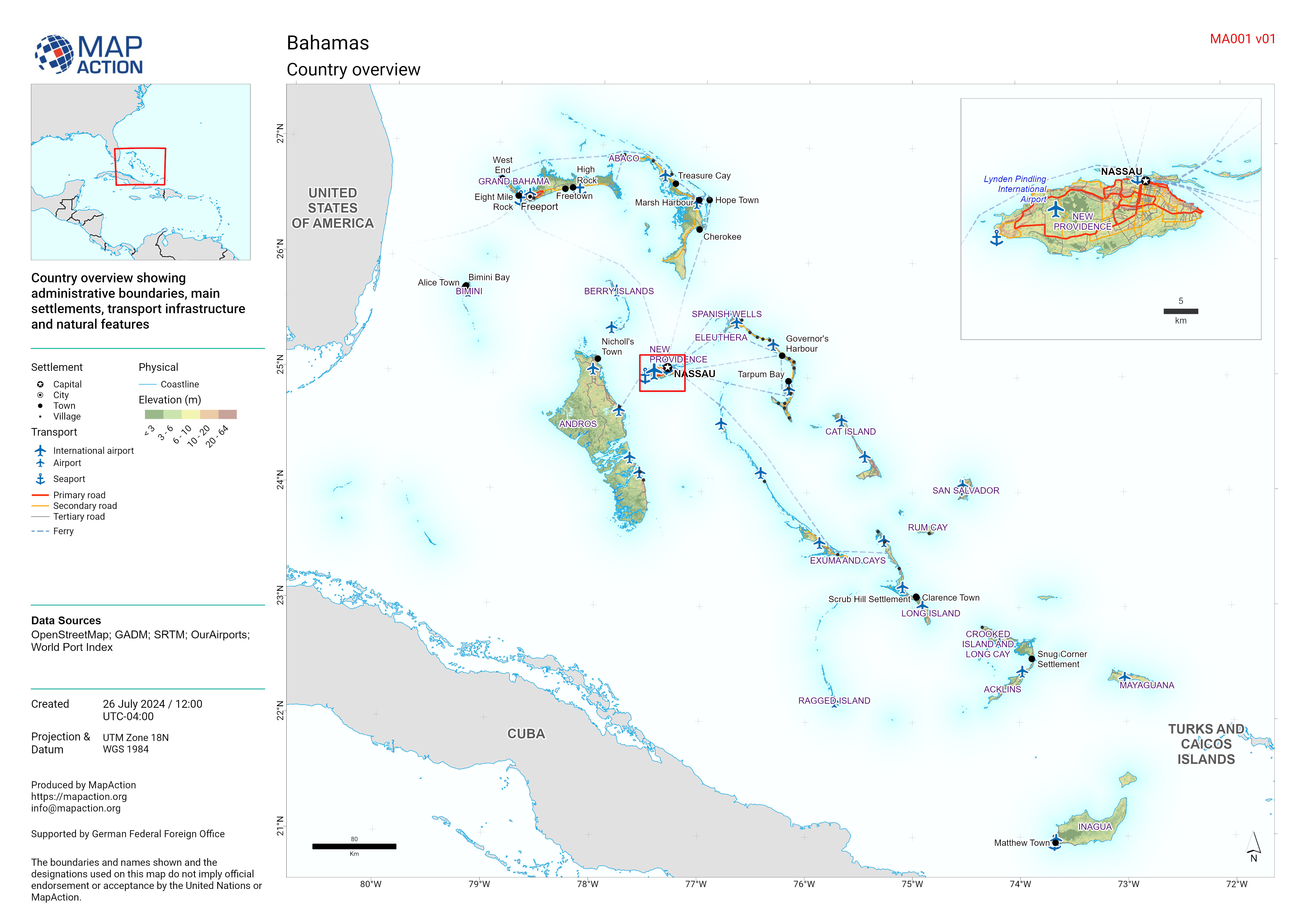
Country overview showing administrative boundaries, main settlements, transport infrastructure and natural features
Source: Country overview
Additional Information
| Field | Value |
|---|---|
| Data last updated | July 26, 2024 |
| Metadata last updated | July 26, 2024 |
| Created | July 26, 2024 |
| Format | JPEG |
| License | License not specified |
| Has views | True |
| Id | 22a66844-8f43-4b31-a207-b47f9ca8bc2e |
| Mimetype | image/jpeg |
| On same domain | True |
| Package id | 91a81ecb-9383-41c6-aa3d-02fa965796fc |
| Position | 1 |
| Revision id | 771cc38a-68eb-45e2-bc4e-47a1d1bfdd2e |
| Size | 1.4 MiB |
| State | active |
| Url type | upload |