MA001-v01-bgd-country-overview-map-300dpi.jpg
From the dataset abstract
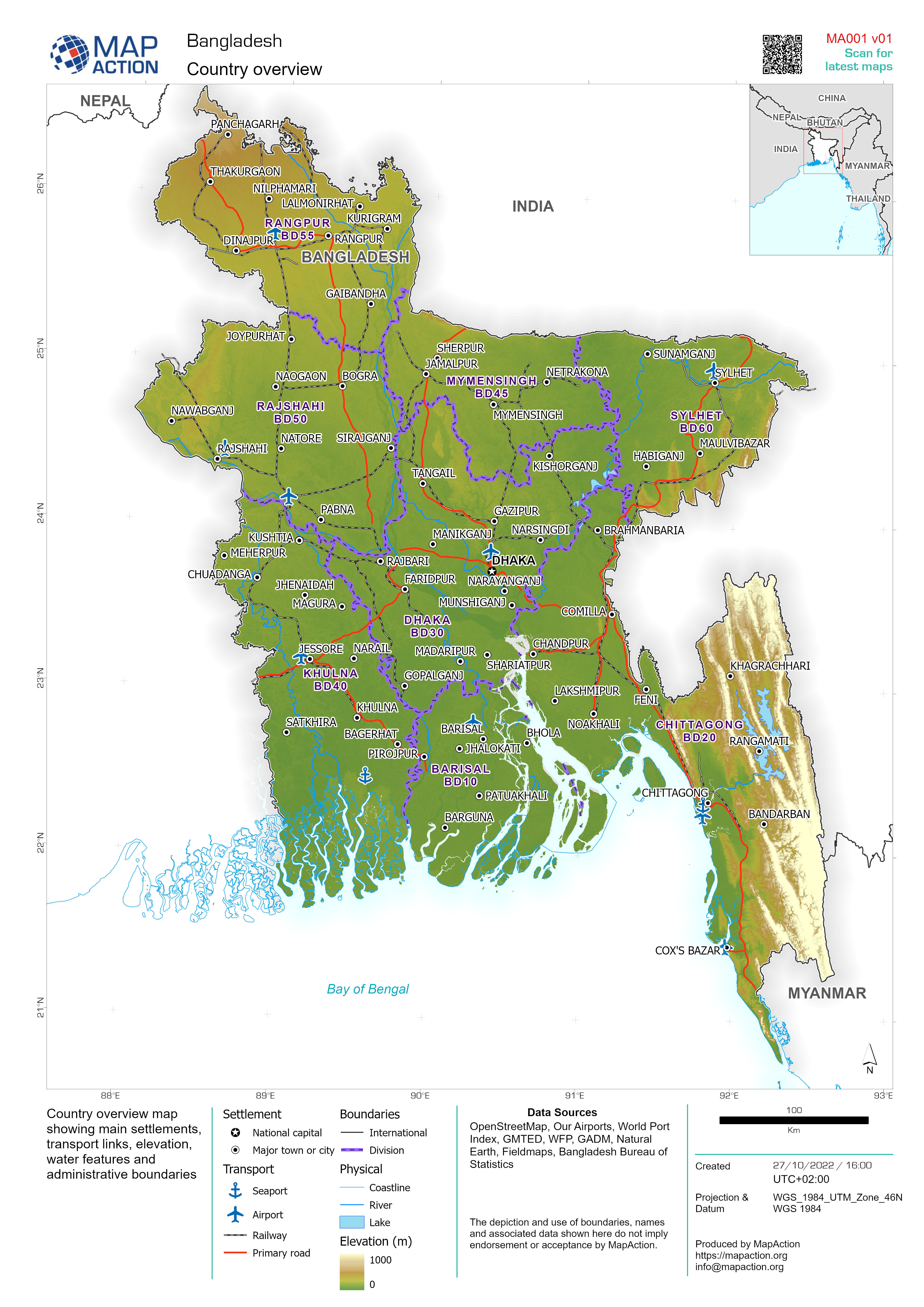
Country overview map showing main settlements, transport links, elevation, water features and administrative boundaries
Source: Bangladesh country overview 2022
Additional Information
| Field | Value |
|---|---|
| Data last updated | October 27, 2022 |
| Metadata last updated | October 27, 2022 |
| Created | October 27, 2022 |
| Format | JPEG |
| License | License not specified |
| Has views | True |
| Id | 4091a08f-fbc4-4c46-9748-230202f1ef2a |
| Mimetype | image/jpeg |
| On same domain | True |
| Package id | 29e3661a-986a-4f43-861f-5d05019b30b2 |
| Position | 1 |
| Revision id | 5086ae59-5c57-4dd8-86d7-4e47426cc4e6 |
| Size | 2.1 MiB |
| State | active |
| Url type | upload |