thumbnail.png
From the dataset abstract
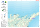
1:100,000 topographical map of Fiji showing physical, transport, settlement and other key features.
Source: Fiji: Cyclone Winston - Topographical - 6 - Dogotuki
Additional Information
| Field | Value |
|---|---|
| Data last updated | July 28, 2016 |
| Metadata last updated | July 28, 2016 |
| Created | July 28, 2016 |
| Format | PNG |
| License | License not specified |
| Has views | True |
| Id | 73406801-6765-4aaf-95bc-b35daa03da29 |
| On same domain | True |
| Package id | 93483d4a-5f9d-452f-bb51-b1dc268f5b52 |
| Position | 2 |
| Revision id | 1bc09f42-1b93-4ec7-a854-12a36e365494 |
| State | active |
| Url type | upload |