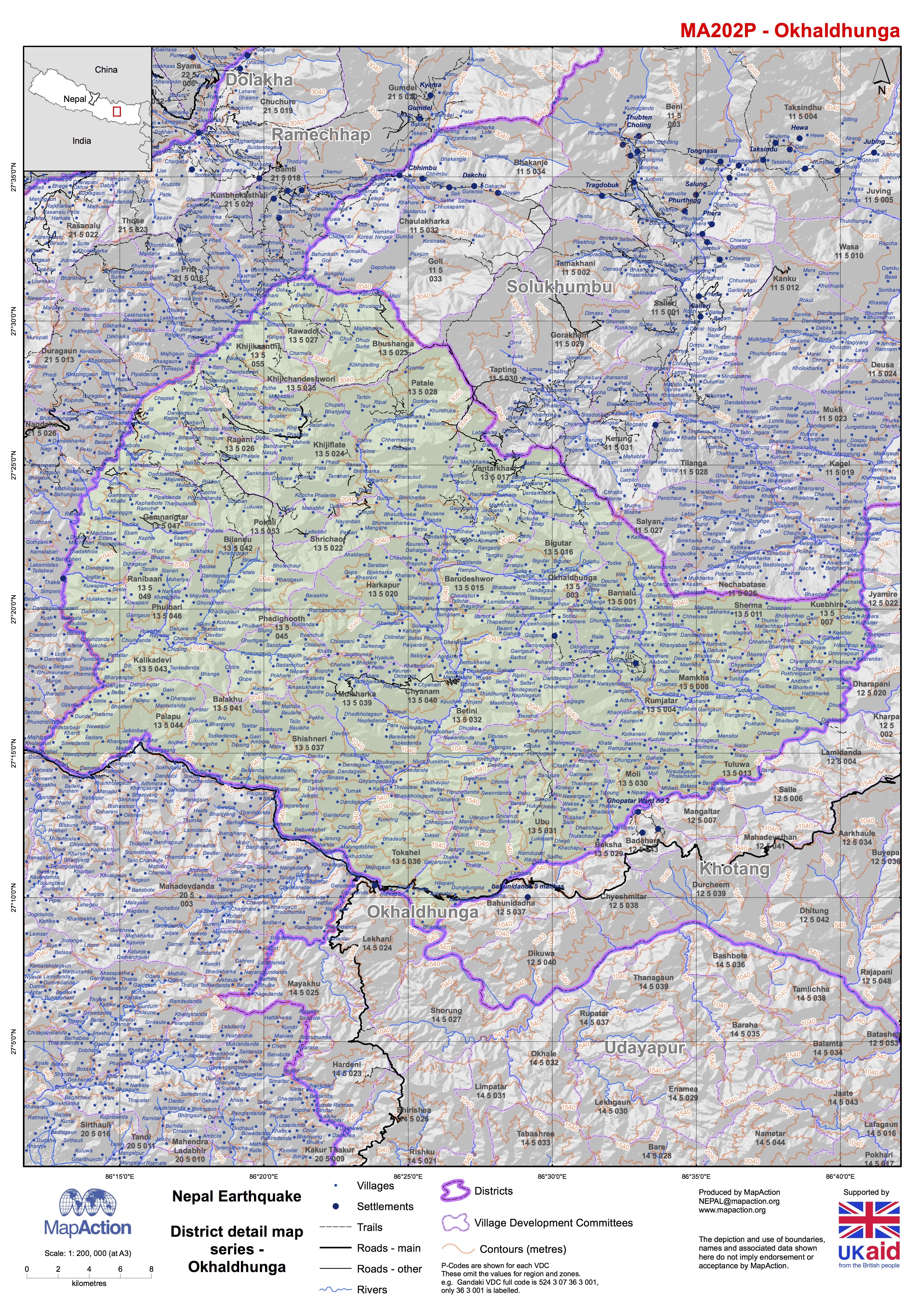
MA202_Okhaldhunga.jpg
From the dataset abstract
Map shows the terrain, roads, rivers and settlements.
Source: Nepal: Earthquake - District detail map series - Okhaldhunga
Additional Information
| Field | Value |
|---|---|
| Data last updated | July 4, 2016 |
| Metadata last updated | July 4, 2016 |
| Created | July 4, 2016 |
| Format | JPEG |
| License | License not specified |
| Has views | True |
| Id | 51195a43-68d5-4e33-a090-eaf90ea342db |
| On same domain | True |
| Package id | 6b61538b-e493-4452-86aa-1052af4781aa |
| Revision id | 7c41cfb6-de4c-4e7d-a103-d9ae70524bdb |
| State | active |
| Url type | upload |
