MA014_T00P00C00_shelters-300dpi.jpeg
From the dataset abstract
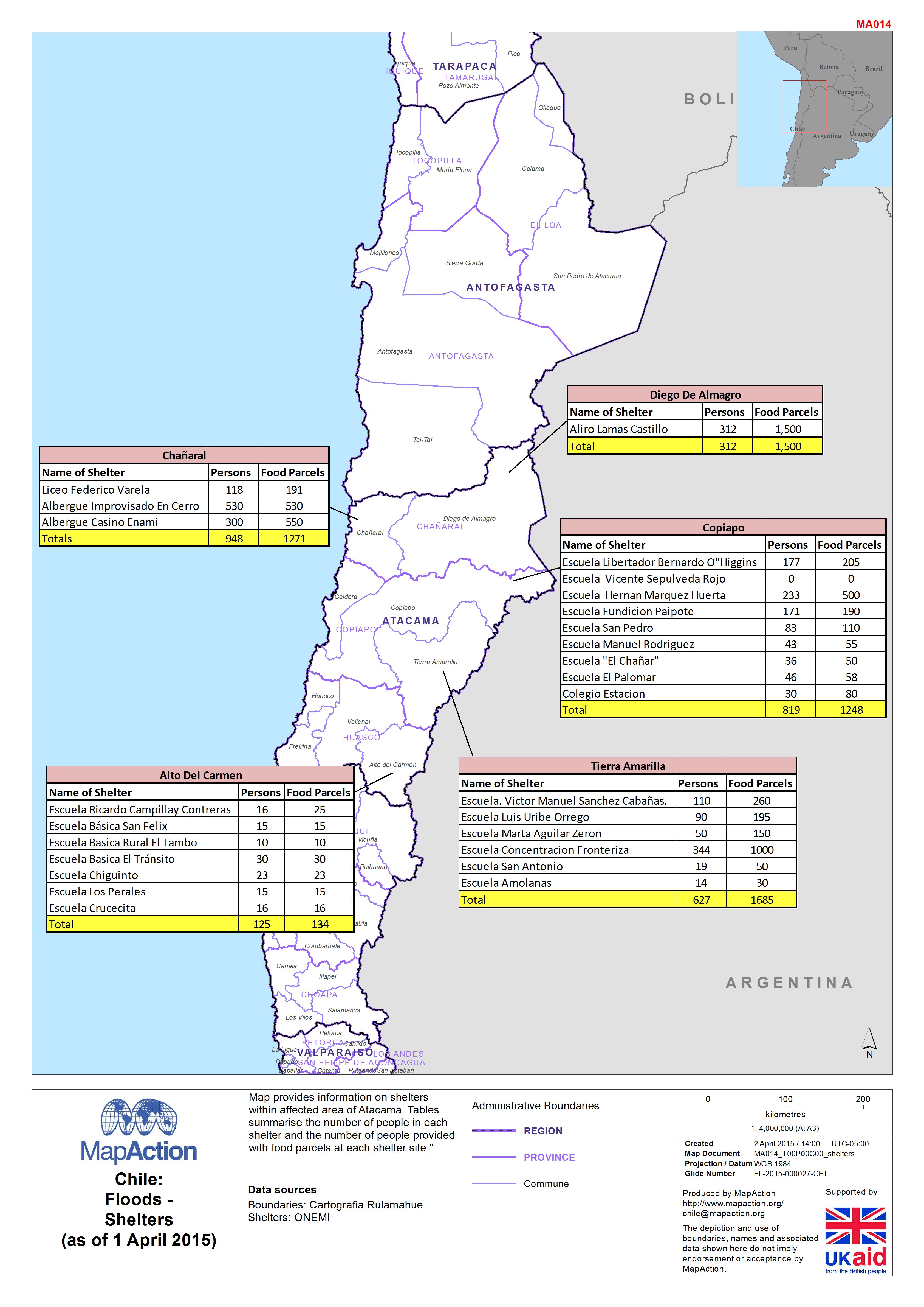
Map provides information on shelters within affected area of Atacama. Tables summarise the number of people in each shelter and the number of people provided with food parcels at each...
Additional Information
| Field | Value |
|---|---|
| Data last updated | July 4, 2016 |
| Metadata last updated | July 4, 2016 |
| Created | July 4, 2016 |
| Format | JPEG |
| License | License not specified |
| Has views | True |
| Id | 748460b1-e060-4f15-823c-ba0f291c15f8 |
| On same domain | True |
| Package id | ede14de1-bfaf-4dff-a676-a2d276df6e70 |
| Revision id | 80272777-8bef-4059-8616-4affc4a2656f |
| State | active |
| Url type | upload |