thumbnail.png
From the dataset abstract
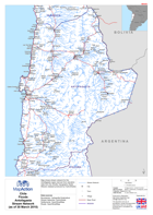
Map shows stream network for the Antofagasta region derived from elevation data from the Shuttle Topography Radar Mission (dataset produced by HydroSheds)
Source: Chile: Floods - Antofagasta Stream Network(as of 30 March 2015)
Additional Information
| Field | Value |
|---|---|
| Data last updated | July 28, 2016 |
| Metadata last updated | July 28, 2016 |
| Created | July 28, 2016 |
| Format | PNG |
| License | License not specified |
| Has views | True |
| Id | bbcd0adf-10c4-4ee5-8618-bb11f66ccd56 |
| On same domain | True |
| Package id | 69b1ba9e-849a-4796-aa8b-2d09c3e0bff0 |
| Position | 2 |
| Revision id | ce435918-2840-445e-a391-2b32f862b0e9 |
| State | active |
| Url type | upload |