MA117_Flood_ModelsA3-300dpi.jpeg
From the dataset abstract
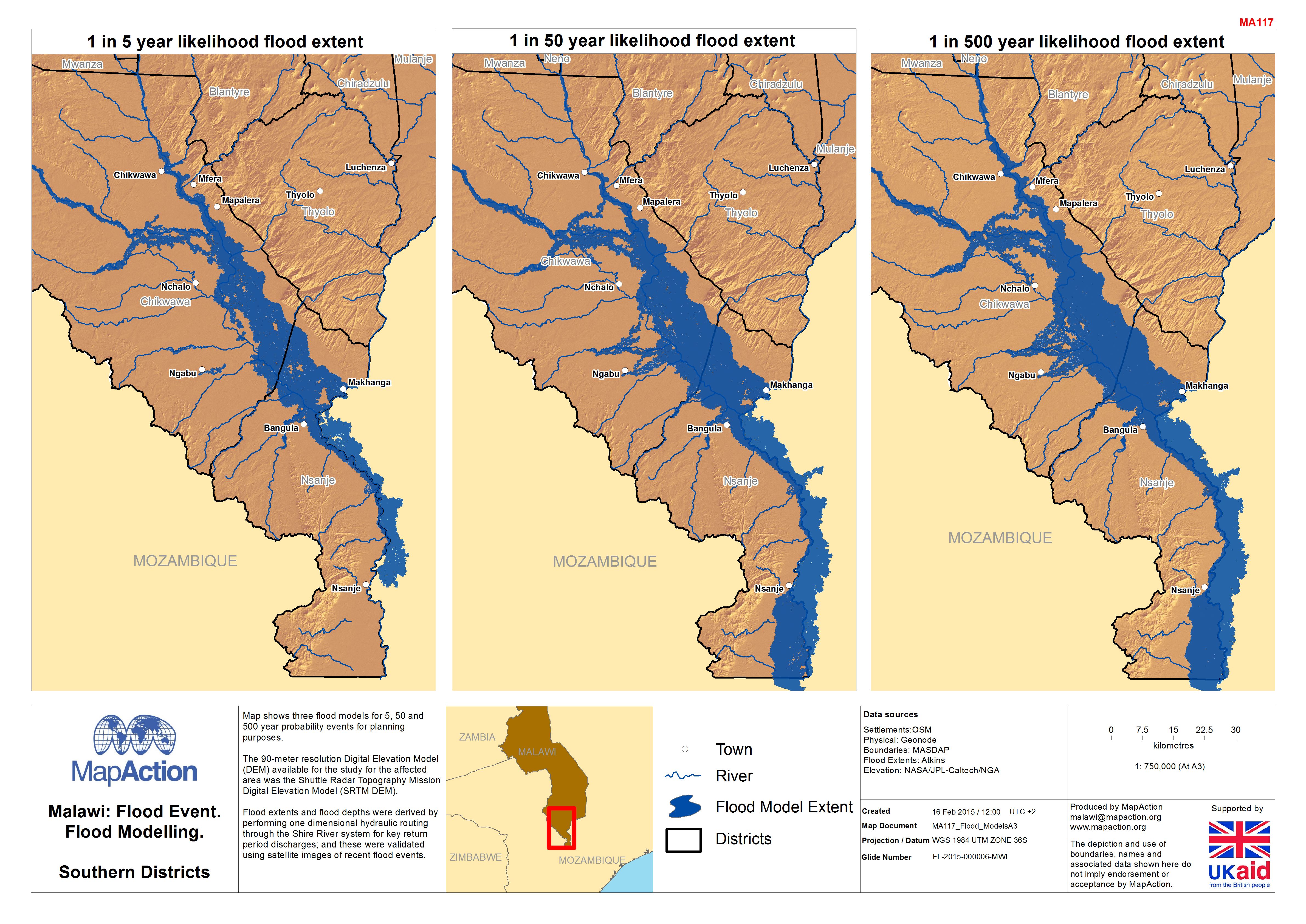
Map shows three flood models for 5, 50 and 500 year probability events for planning purposes. The 90-metre resolution Digital Elevation Model (DEM) available for the study for the...
Source: Malawi: Floods - Flood Modelling, Southern Districts
Additional Information
| Field | Value |
|---|---|
| Data last updated | July 4, 2016 |
| Metadata last updated | July 4, 2016 |
| Created | July 4, 2016 |
| Format | JPEG |
| License | License not specified |
| Has views | True |
| Id | a7f8c7a9-389b-4f9c-bc58-5abb147bacfd |
| On same domain | True |
| Package id | 55984905-bc27-4148-8c84-018fcea105dc |
| Revision id | b9084872-5237-41be-bf6f-939533dd82fb |
| State | active |
| Url type | upload |
