MA009_EbolaCareFacilities_Case_A3_v4-300dpi.jpeg
From the dataset abstract
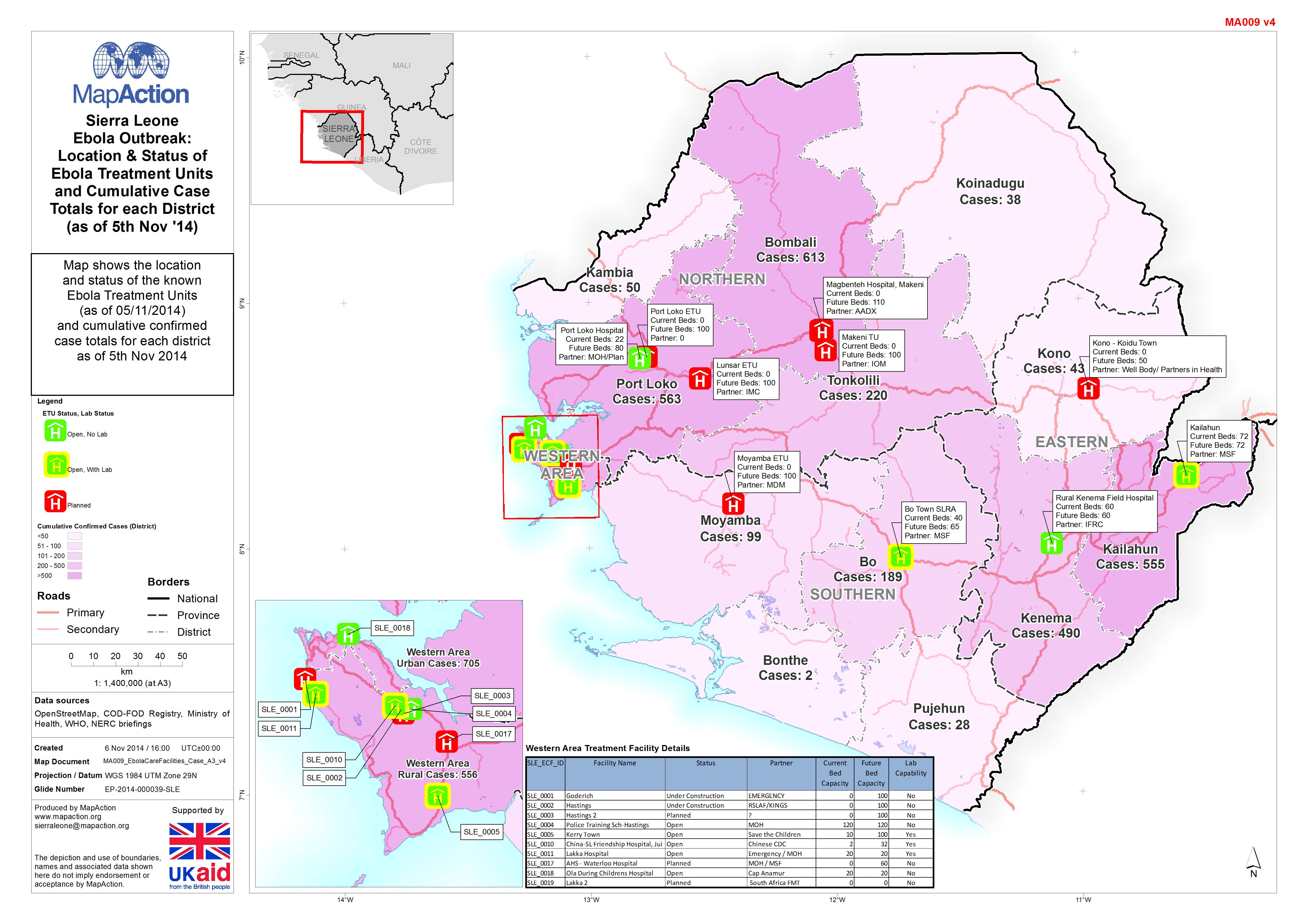
Map shows the location and status of the known Ebola Treatment Units (as of 05/11/2014) and cumulative confirmed case totals for each district as of 5th Nov 2014.
Additional Information
| Field | Value |
|---|---|
| Data last updated | July 4, 2016 |
| Metadata last updated | July 4, 2016 |
| Created | July 4, 2016 |
| Format | JPEG |
| License | License not specified |
| Has views | True |
| Id | 9f6922f3-da61-4b95-b9e2-d2c70cc7099f |
| On same domain | True |
| Package id | 0386f8a5-0a90-4339-a6ea-2d9462df4c2f |
| Revision id | 0457d2ca-a245-4aa6-bc19-3b44ce9ab36f |
| State | active |
| Url type | upload |