MA021_PopDensityWesternArea-300dpi.jpeg
From the dataset abstract
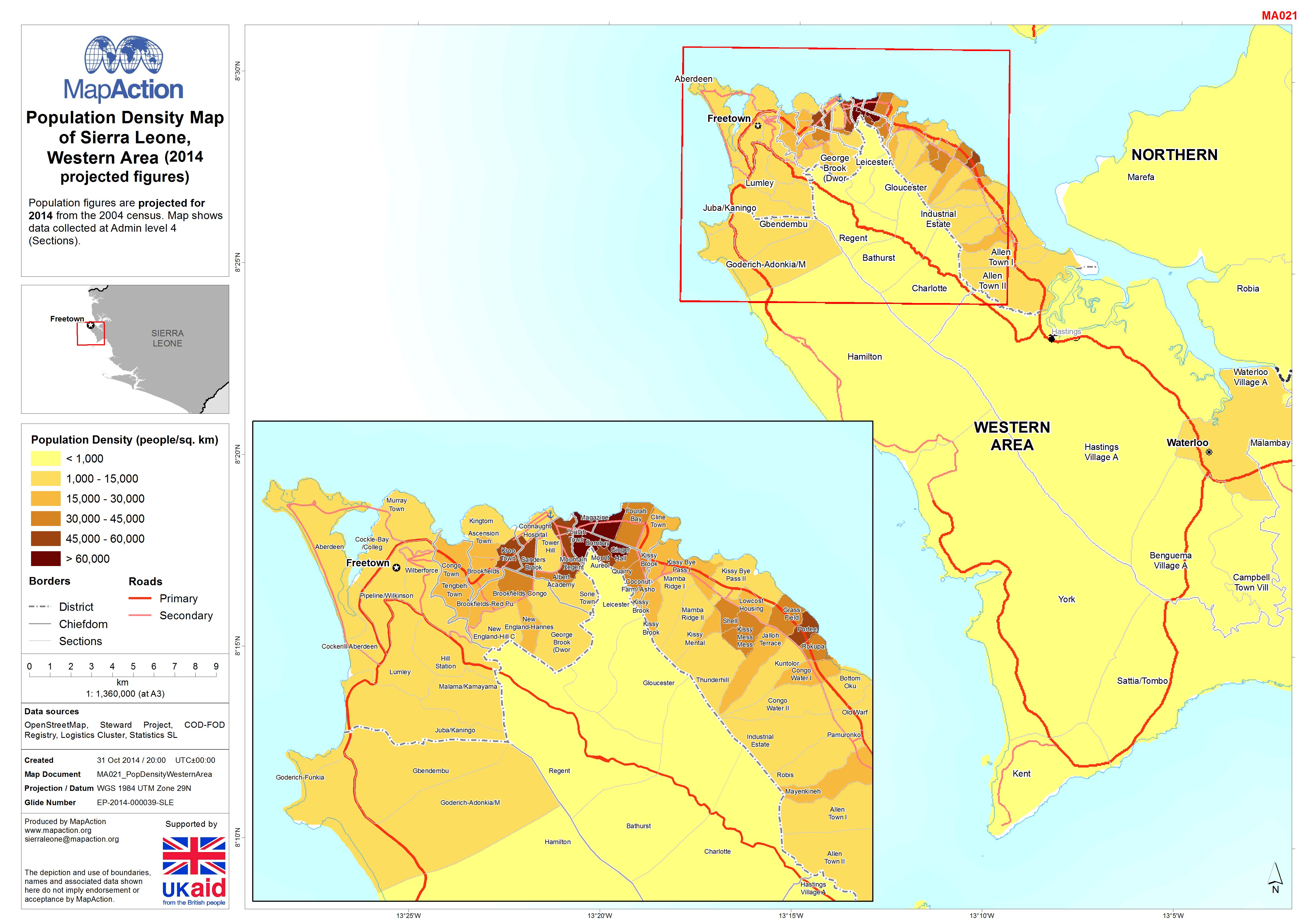
Population figures are projected for 2014 from the 2004 census. Map shows data collected at Admin level 4 (Sections).
Source: Population Density Map of Sierra Leone, Western Area
Additional Information
| Field | Value |
|---|---|
| Data last updated | July 4, 2016 |
| Metadata last updated | July 4, 2016 |
| Created | July 4, 2016 |
| Format | JPEG |
| License | License not specified |
| Has views | True |
| Id | 6df842c4-82fd-4589-93f9-d5b0c7140a5f |
| On same domain | True |
| Package id | ea3d9a47-7f80-4bdd-8a9a-3f6d5c849113 |
| Revision id | b99ea371-a691-40e6-be79-5464bf2ce585 |
| State | active |
| Url type | upload |