MA001_T00C00P00_3W_2014_06_19.jpg
From the dataset abstract
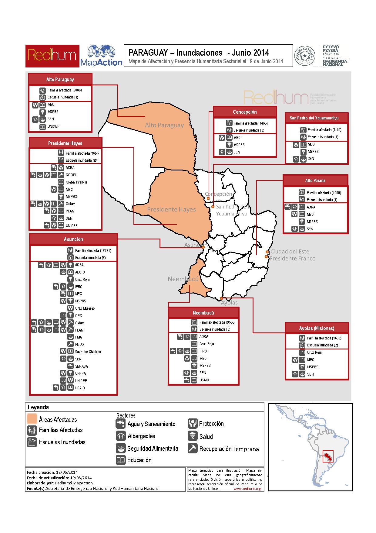
Map represents humanitarian sector presence in the most affected areas (Alto Paraguay, Presidente Hayes (Bajo Chaco), Asuncion, Ñeembucú).
Source: Paraguay: Inundaciones - Mapa de Afectación y Presencia Humanitaria Sectorial al 19 de Junio 2014
Additional Information
| Field | Value |
|---|---|
| Data last updated | July 4, 2016 |
| Metadata last updated | July 4, 2016 |
| Created | July 4, 2016 |
| Format | JPEG |
| License | License not specified |
| Has views | True |
| Id | d4ba4c6a-4682-45ba-bd81-12fe427cb690 |
| On same domain | True |
| Package id | 42673bad-dbc9-4a29-be94-1ccf61b4577e |
| Revision id | 2700a359-b6df-4723-a256-eb2c6801f8e3 |
| State | active |
| Url type | upload |