MA007_ObrenovacFloodRisk71_A3L-300dpi.jpeg
From the dataset abstract
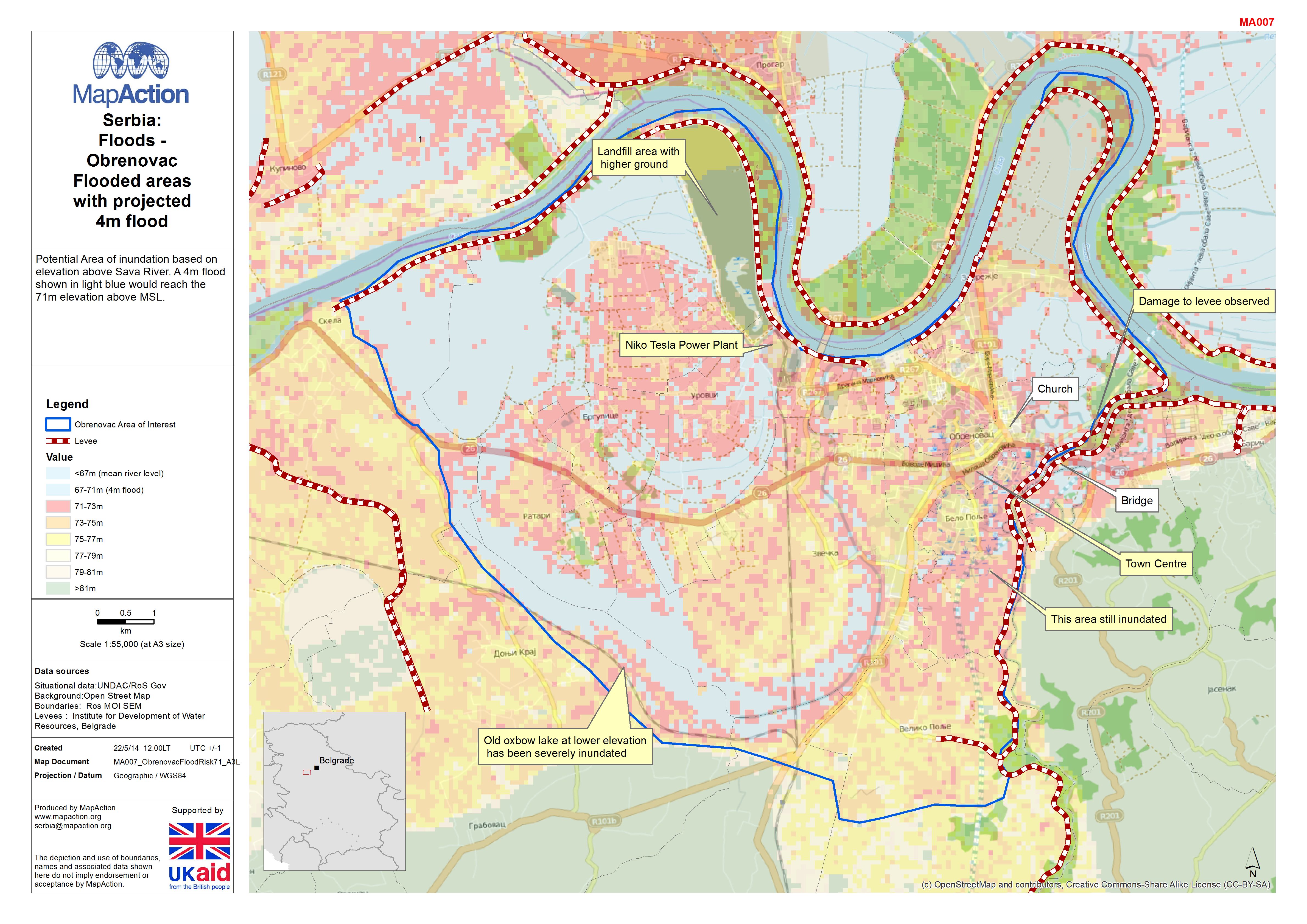
Potential Area of inundation based on elevation above Sava River. A 4m flood shown in light blue would reach the 71m elevation above MSL.
Source: Serbia: Floods - Obrenovac Flooded areas with projected 4m flood
Additional Information
| Field | Value |
|---|---|
| Data last updated | July 4, 2016 |
| Metadata last updated | July 4, 2016 |
| Created | July 4, 2016 |
| Format | JPEG |
| License | License not specified |
| Has views | True |
| Id | 69cfa010-9ebf-4ba9-96b9-f76c494124f7 |
| On same domain | True |
| Package id | f1242201-fc52-42fe-9e57-b5ef508781b7 |
| Revision id | 9bf02b0b-ec95-4fbd-8607-bb63058d82c3 |
| State | active |
| Url type | upload |
