thumbnail.png
From the dataset abstract
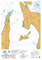
Map shows Admiralty Chart No. 4477 to show bathymetry between Leyte and Cebu. Basic land infrastructure and admin boundaries are shown for reference.
Source: Philippines Typhoon Haiyan (Yolanda) Admiralty Chart - Camotes Sea (as of 20 Nov-2013)
Additional Information
| Field | Value |
|---|---|
| Data last updated | July 28, 2016 |
| Metadata last updated | July 28, 2016 |
| Created | July 28, 2016 |
| Format | PNG |
| License | License not specified |
| Has views | True |
| Id | 15ac6982-5f4c-4e85-a3dc-132543a6da20 |
| On same domain | True |
| Package id | 3ff2d176-26fe-4e90-a1f6-5f0bfb91a6e2 |
| Position | 2 |
| Revision id | 1389b2e0-8a6e-4502-b899-ac3b81a3e5b3 |
| State | active |
| Url type | upload |