MA013h_EvacuationCentresCentralVisayas_v02-300d ...
From the dataset abstract
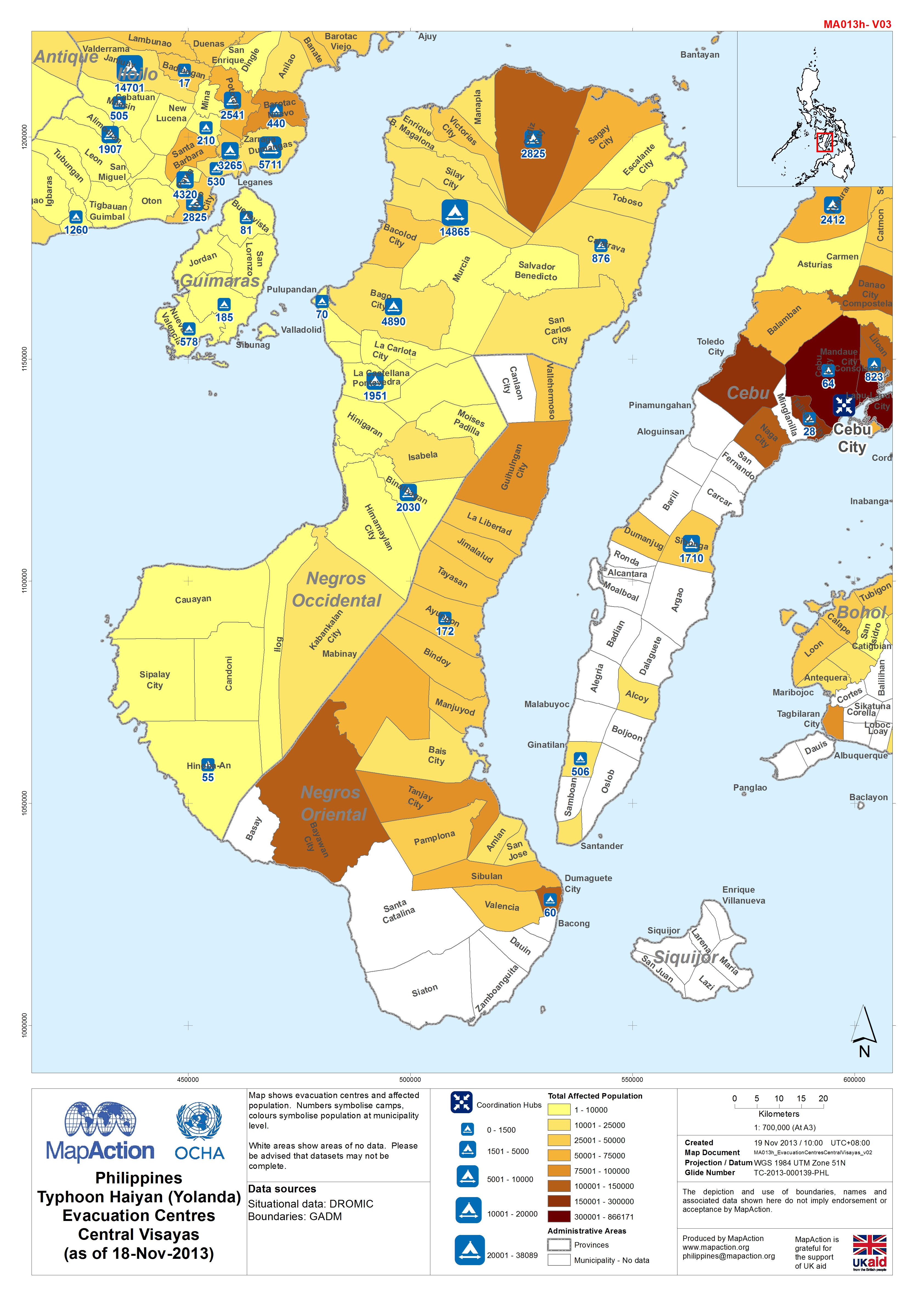
Map shows evacuation centres and affected population. Numbers symbolise camps, colours symbolise population at municipality level.White areas show areas of no data. Please be advised that...
Source: Philippines Typhoon Haiyan (Yolanda) Evacuation Centres Central Visayas (as of 18-Nov-2013)
Additional Information
| Field | Value |
|---|---|
| Data last updated | July 4, 2016 |
| Metadata last updated | July 4, 2016 |
| Created | July 4, 2016 |
| Format | JPEG |
| License | License not specified |
| Has views | True |
| Id | 2f4055ad-7673-40bc-8796-46d1f1c451a0 |
| On same domain | True |
| Package id | 3643f800-c57f-489a-adb9-d139208da79b |
| Revision id | 7779d6b2-017f-4e69-bd28-1d99d8c2a5f6 |
| State | active |
| Url type | upload |