MA005E_Infrastructure_Leyte_v02-300dpi.jpeg
From the dataset abstract
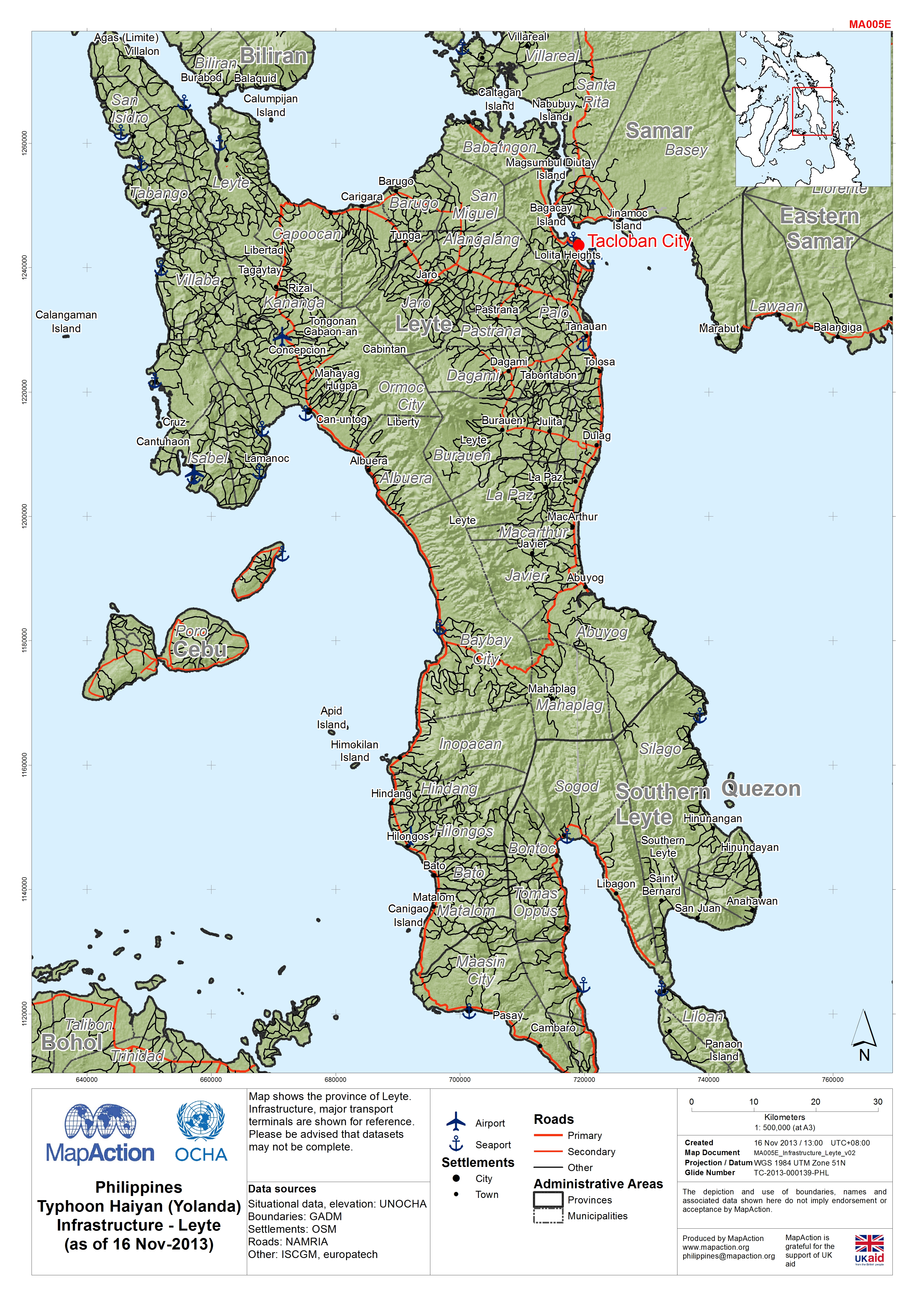
Map shows the province of Leyte. Infrastructure, major transport terminals are shown for reference. Please be advised that datasets may not be complete.
Source: Philippines Typhoon Haiyan (Yolanda) Infrastructure - Leyte (as of 16 Nov-2013)
Additional Information
| Field | Value |
|---|---|
| Data last updated | July 4, 2016 |
| Metadata last updated | July 4, 2016 |
| Created | July 4, 2016 |
| Format | JPEG |
| License | License not specified |
| Has views | True |
| Id | f25c3af9-3213-4b5b-8130-ce3f305c6e35 |
| On same domain | True |
| Package id | 500e240b-3952-42c6-bdb3-b8dd52f09790 |
| Revision id | 145c0a19-d3c4-4278-9136-064d602a3252 |
| State | active |
| Url type | upload |