MA018A_W_Visayas_01-300dpi.jpeg
From the dataset abstract
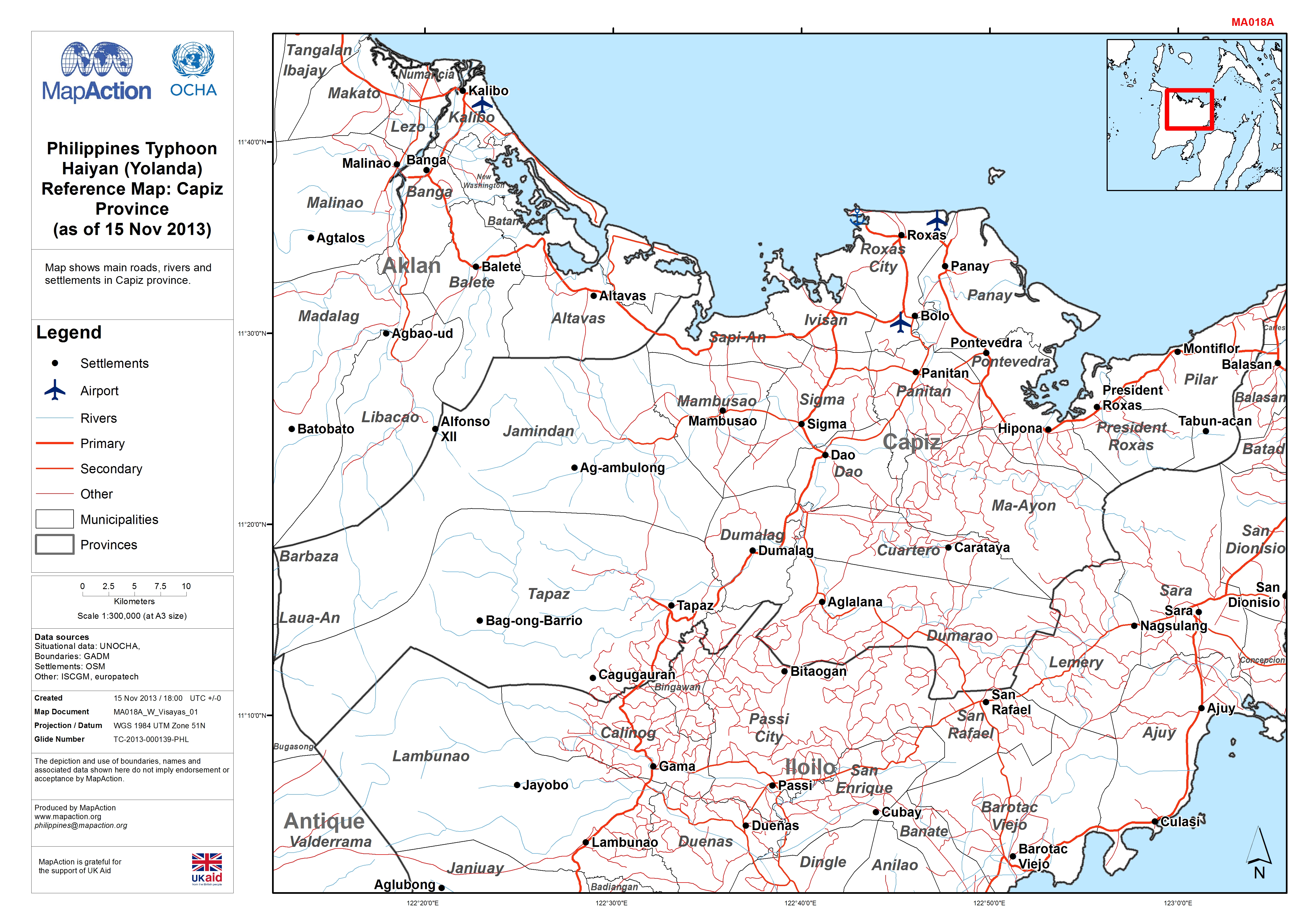
Map shows main roads, rivers and settlements in Capiz province.
Source: Philippines Typhoon Haiyan (Yolanda) Reference Map: Capiz Province (as of 15 Nov 2013)
Additional Information
| Field | Value |
|---|---|
| Data last updated | July 4, 2016 |
| Metadata last updated | July 4, 2016 |
| Created | July 4, 2016 |
| Format | JPEG |
| License | License not specified |
| Has views | True |
| Id | 60e13d58-b38c-4d8c-b8c8-dee0c6f0fec9 |
| On same domain | True |
| Package id | 7a3842a2-80b4-478e-9173-4b03c2ba36d5 |
| Revision id | 8a2cce46-5ed2-42bb-abe5-2e198a003b96 |
| State | active |
| Url type | upload |
