MA013i_EvacCentresWesternVisayas_v02-300dpi.jpeg
From the dataset abstract
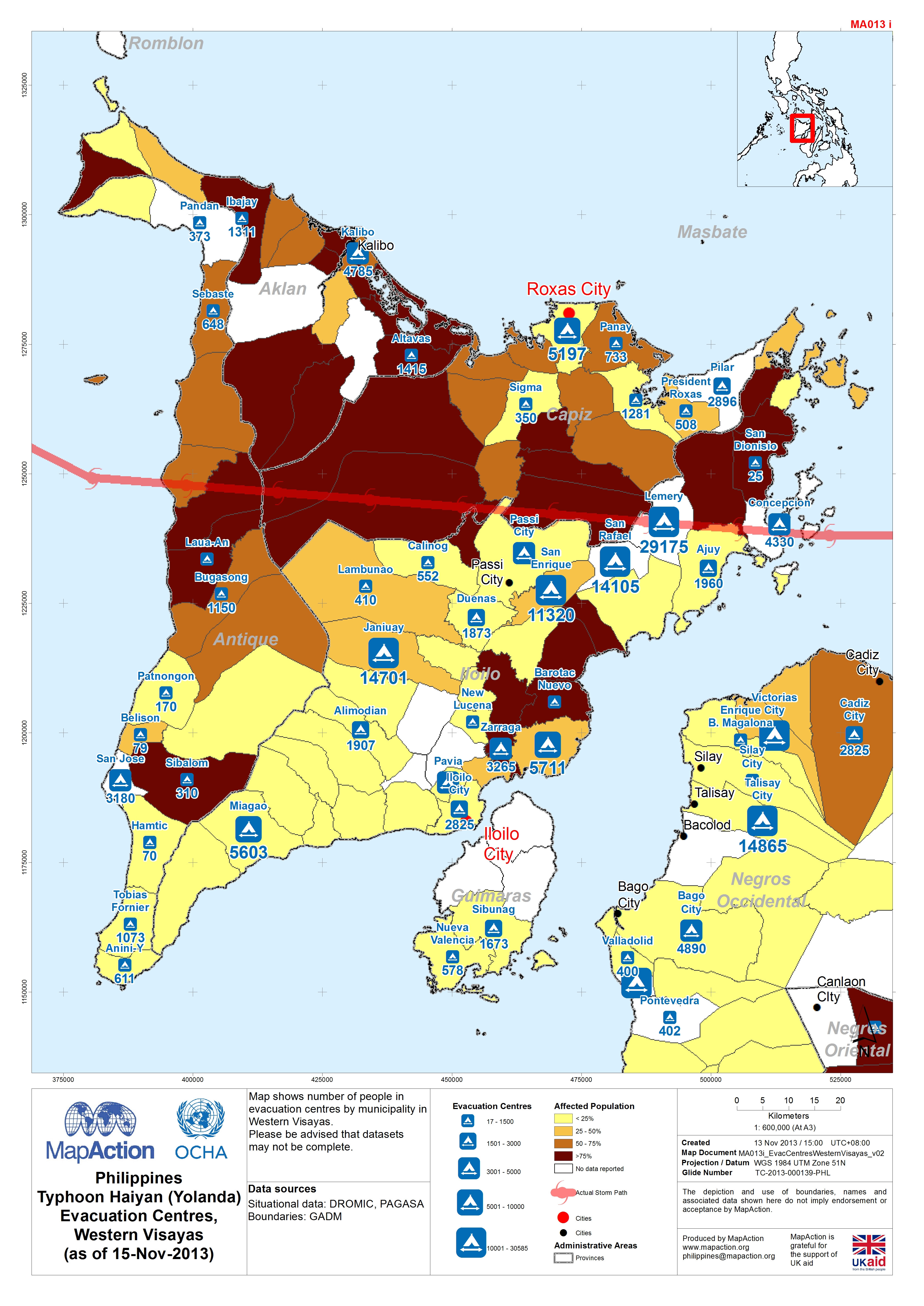
Map shows number of people in evacuation centres by municipality in Western Visayas. Please be advised that datasets may not be complete.
Source: Philippines Typhoon Haiyan (Yolanda) Evacuation Centres, Western Visayas (as of 15-Nov-2013)
Additional Information
| Field | Value |
|---|---|
| Data last updated | July 4, 2016 |
| Metadata last updated | July 4, 2016 |
| Created | July 4, 2016 |
| Format | JPEG |
| License | License not specified |
| Has views | True |
| Id | 5a9c44d6-7a64-4011-a29e-0a2f43699e0e |
| On same domain | True |
| Package id | 5f576b3c-884b-47f4-9403-566fed4e48da |
| Revision id | a1d4dd28-eac5-41a9-a3f0-7023d17930cf |
| State | active |
| Url type | upload |