thumbnail.png
From the dataset abstract
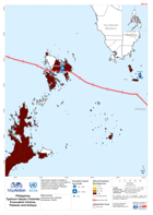
Map shows number of people in evacuation centres by municipality in Palawan and Antique regions.Please be advised that datasets may not be complete.
Source: Philippines Typhoon Haiyan (Yolanda) Evacuation Centres in Palawan and Antique (as of 12-Nov-2013)
Additional Information
| Field | Value |
|---|---|
| Data last updated | July 28, 2016 |
| Metadata last updated | July 28, 2016 |
| Created | July 28, 2016 |
| Format | PNG |
| License | License not specified |
| Has views | True |
| Id | 3edd878a-76f0-469c-81ac-f23de261816f |
| On same domain | True |
| Package id | 28c537ea-2683-438c-b9f6-200ccd48c2c7 |
| Position | 2 |
| Revision id | 6f6a26cf-b325-4fd9-8c40-7f8071edcd81 |
| State | active |
| Url type | upload |