MA022_Hur_Fubar_Norland_Sinderburg_v2.jpg
From the dataset abstract
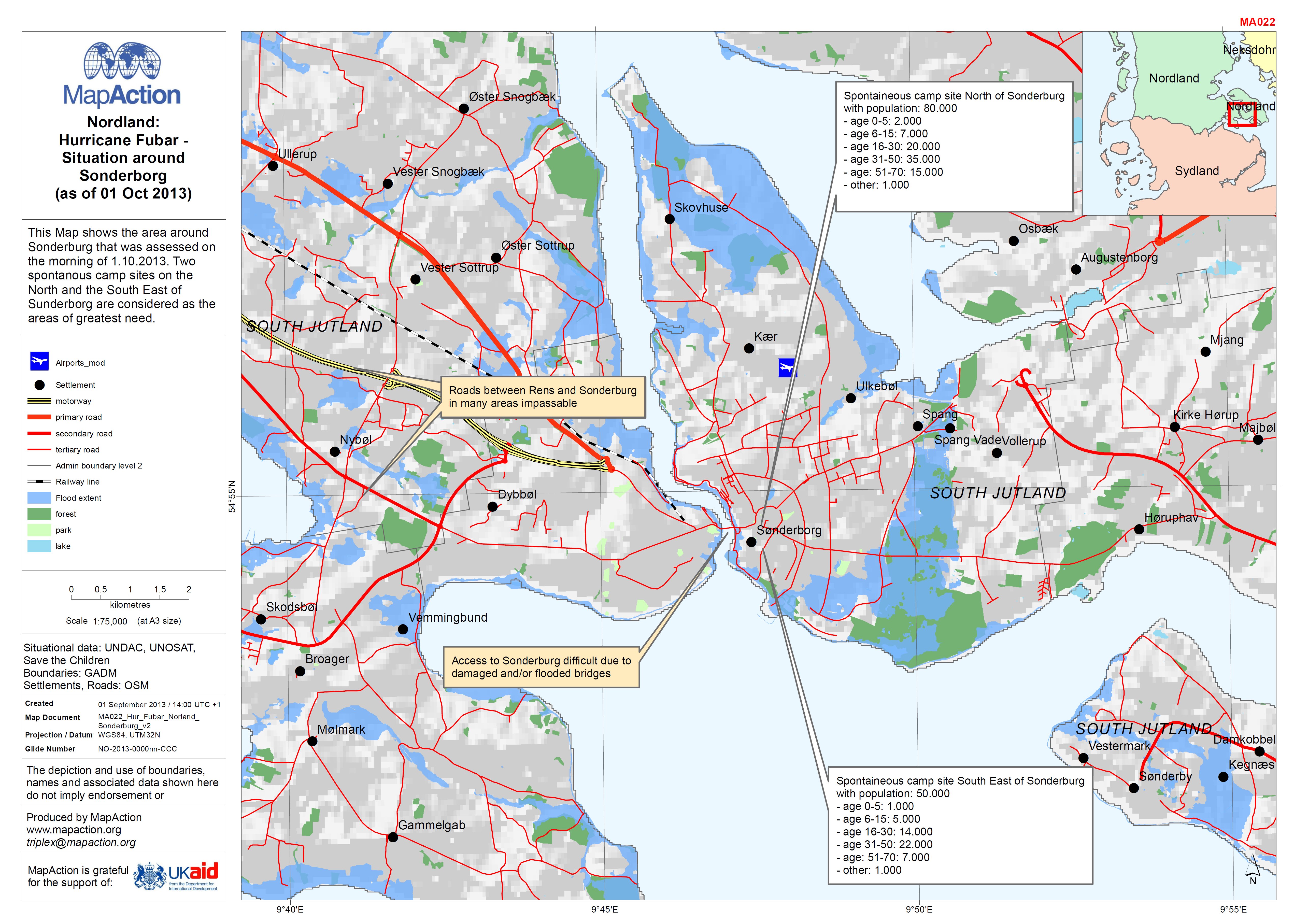
This Map shows the area around Sonderburg that was assessed on the morning of 1.10.2013. Two spontanous camp sites on the North and the South East of Sunderborg are considered as the...
Source: EXERCISE: Nordland: Hurricane Fubar - Situation around Sonderborg (as of 01 Oct 2013)
Additional Information
| Field | Value |
|---|---|
| Data last updated | July 4, 2016 |
| Metadata last updated | July 4, 2016 |
| Created | July 4, 2016 |
| Format | JPEG |
| License | License not specified |
| Has views | True |
| Id | b44ccecb-4bc0-479d-932e-68cf41ba15ab |
| On same domain | True |
| Package id | 258df147-ccb1-48a0-b43b-3dfe93f96296 |
| Revision id | b28e9f6a-0d54-4fe5-a00e-23c7252f0bbe |
| State | active |
| Url type | upload |