MA8010_SyriaGovenorateMaps_mapseries_Landscape_ ...
From the dataset abstract
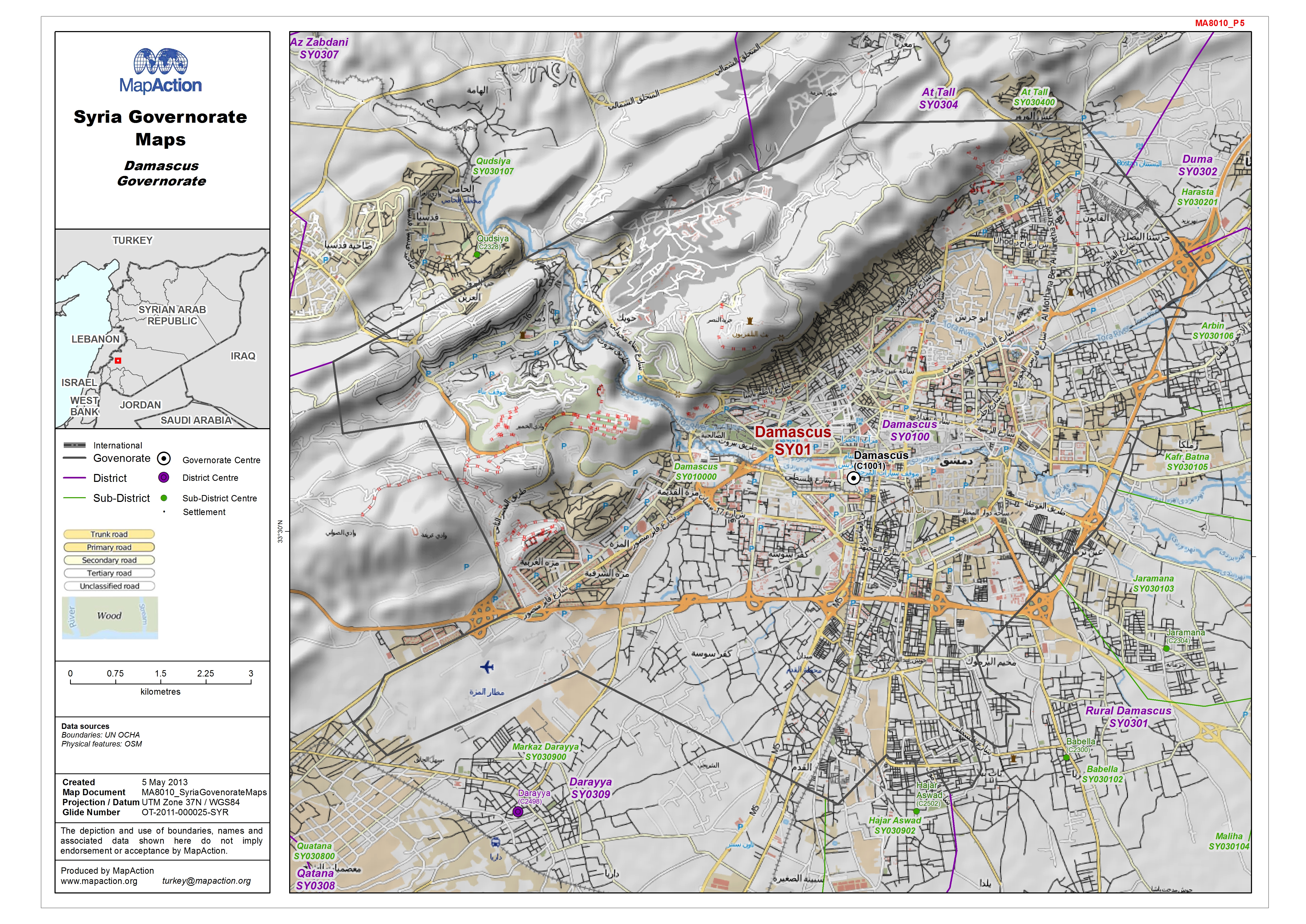
Map of Damascus Governorate showing sub-district boundaries over basemap (includes District and Sub-District names in English with P-Codes)
Additional Information
| Field | Value |
|---|---|
| Data last updated | July 4, 2016 |
| Metadata last updated | July 4, 2016 |
| Created | July 4, 2016 |
| Format | JPEG |
| License | License not specified |
| Has views | True |
| Id | 2bff7639-2442-48bd-b25e-fcae058872e7 |
| On same domain | True |
| Package id | 06fa8377-3c03-481a-a881-d655091e7a41 |
| Revision id | eece912d-4d8e-4674-9a3a-911c5f78c175 |
| State | active |
| Url type | upload |