thumbnail.png
From the dataset abstract
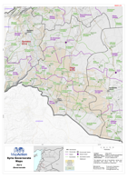
Map of Dara Governorate showing sub-district boundaries over basemap (includes District and Sub-District names in English with P-Codes)
Additional Information
| Field | Value |
|---|---|
| Data last updated | July 28, 2016 |
| Metadata last updated | July 28, 2016 |
| Created | July 28, 2016 |
| Format | PNG |
| License | License not specified |
| Has views | True |
| Id | 6ee1f169-e186-4ddb-bea8-2266ca7582f8 |
| On same domain | True |
| Package id | f2e6a8fd-dd75-4146-a337-1a19835f46a0 |
| Position | 2 |
| Revision id | 870e3788-9ec9-4edc-a748-0397acf61be6 |
| State | active |
| Url type | upload |