thumbnail.png
From the dataset abstract
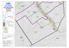
Map of Abu Kamal District in Deir-ez-Zor Governorate, Syria, showing sub-district boundaries over basemap (includes District and Sub-District names in English and Arabic with P-Codes)
Source: Syria - District Maps: Abu Kamal District in Deir-ez-Zor Governorate
Additional Information
| Field | Value |
|---|---|
| Data last updated | July 28, 2016 |
| Metadata last updated | July 28, 2016 |
| Created | July 28, 2016 |
| Format | PNG |
| License | License not specified |
| Has views | True |
| Id | bd09ebf4-5743-493c-8693-e22c2fb84c36 |
| On same domain | True |
| Package id | 02c0f155-cd68-4824-bf79-0810cbdecd22 |
| Position | 2 |
| Revision id | f11fb28a-d938-4294-8c08-0321ab167421 |
| State | active |
| Url type | upload |