MA5007_SyriaDistrictMaps_P37_Masyaf.jpg
From the dataset abstract
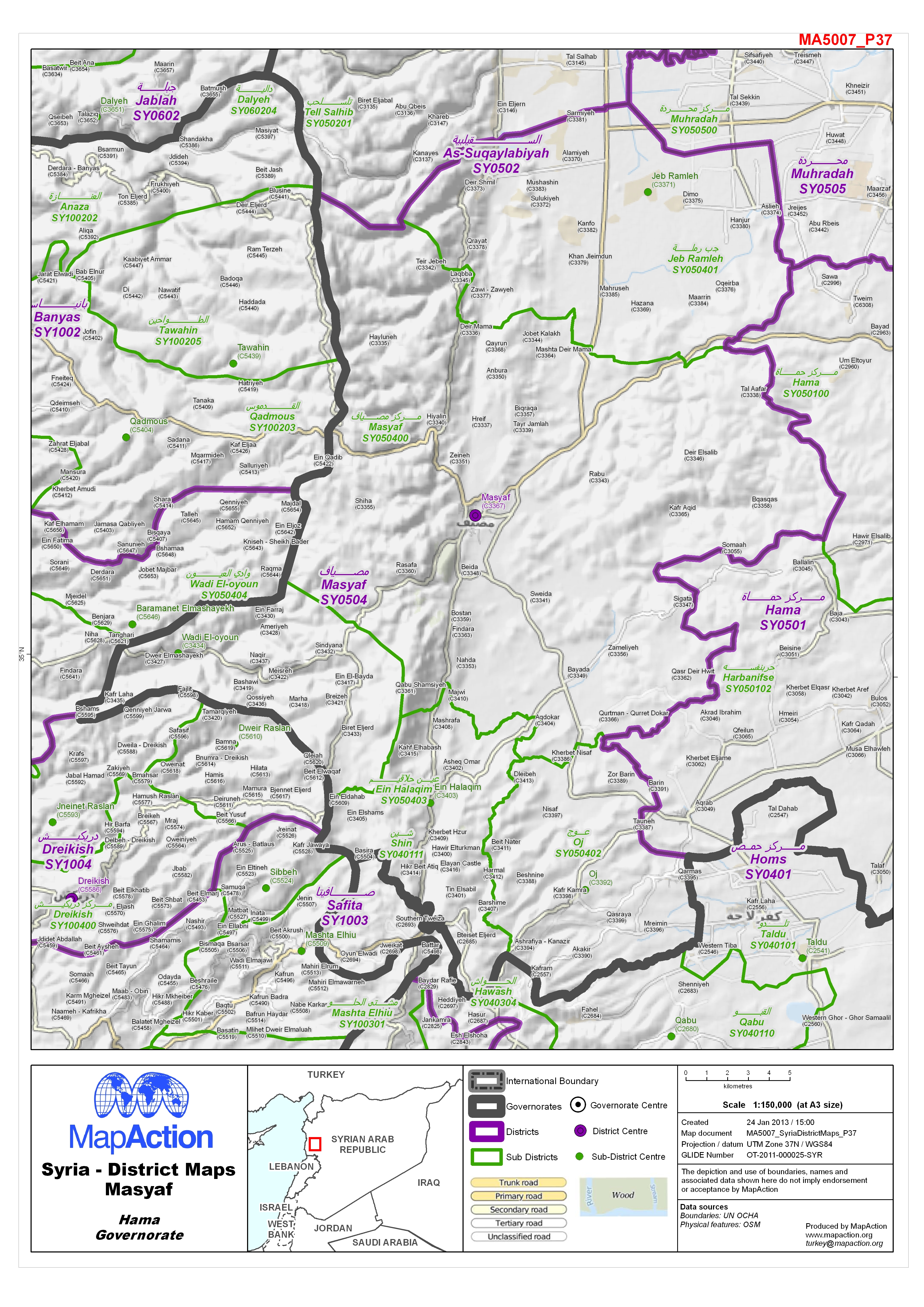
Map of Masyaf District in Hama Governorate, Syria, showing sub-district boundaries over basemap (includes District and Sub-District names in English and Arabic with P-Codes)
Source: Syria - District Maps: Masyaf District in Hama Governorate
Additional Information
| Field | Value |
|---|---|
| Data last updated | July 4, 2016 |
| Metadata last updated | July 4, 2016 |
| Created | July 4, 2016 |
| Format | JPEG |
| License | License not specified |
| Has views | True |
| Id | f61c355c-c962-4fa8-bf4f-bcd501de1e52 |
| On same domain | True |
| Package id | 624891a2-9266-4af1-8d39-4ba50b786e8c |
| Revision id | 55a9f743-dd8d-48ca-b003-d90e08fe3da9 |
| State | active |
| Url type | upload |