MA004_StormPath-300dpi.jpg
From the dataset abstract
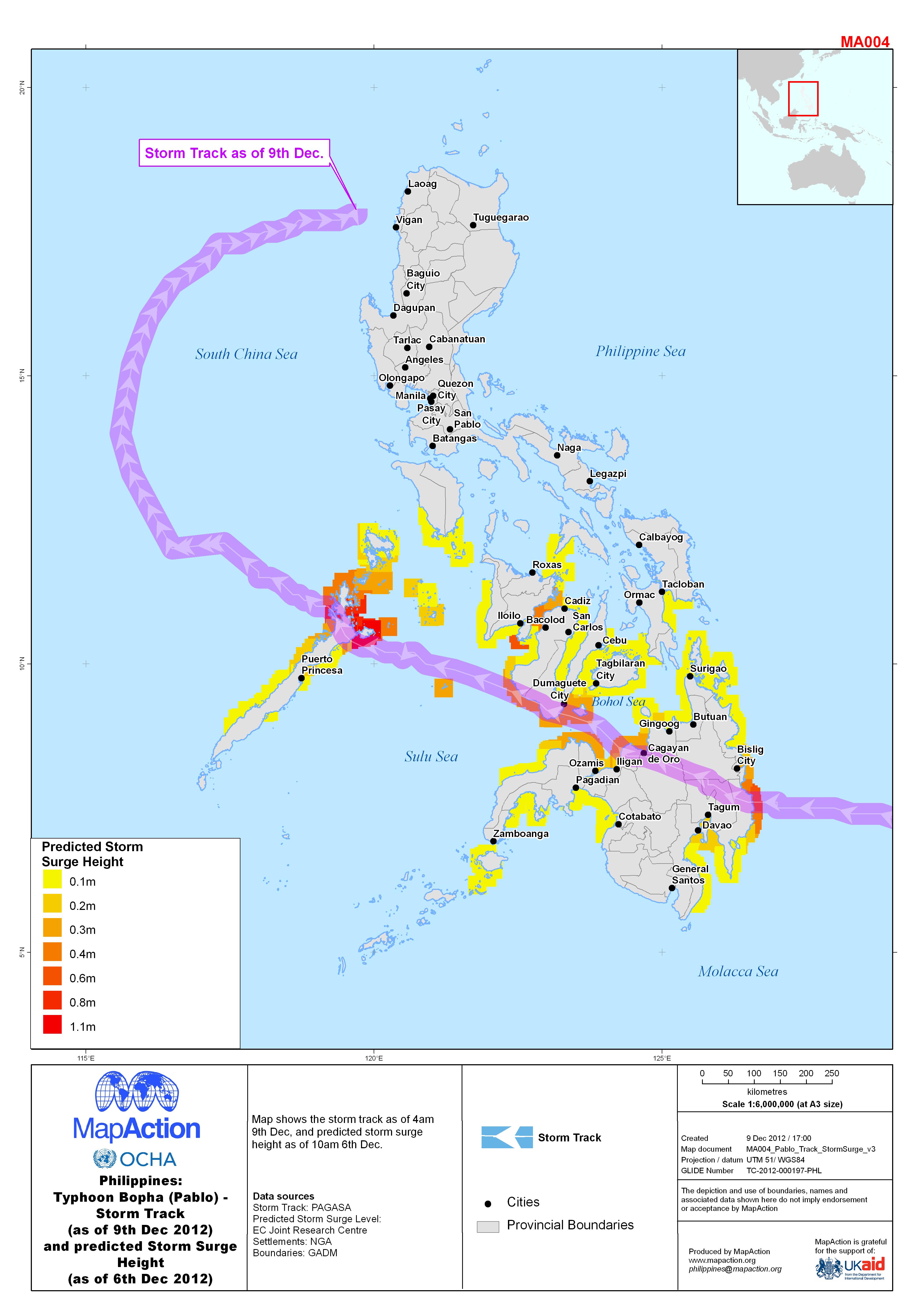
Map shows the storm track as of 4am 9th Dec, and predicted storm surge height as of 10am 6th Dec.
Additional Information
| Field | Value |
|---|---|
| Data last updated | July 4, 2016 |
| Metadata last updated | July 4, 2016 |
| Created | July 4, 2016 |
| Format | JPEG |
| License | License not specified |
| Has views | True |
| Id | cbd582b7-93a7-4132-a224-f43256036157 |
| On same domain | True |
| Package id | 5c5a5d3e-e703-4c64-b6d4-e29caa16c8ea |
| Revision id | a2a212c4-5e5d-4133-9be9-864f674be7f9 |
| State | active |
| Url type | upload |
