MA005_T00C01P00_COM_AffectedArea-300dpi.jpg
From the dataset abstract
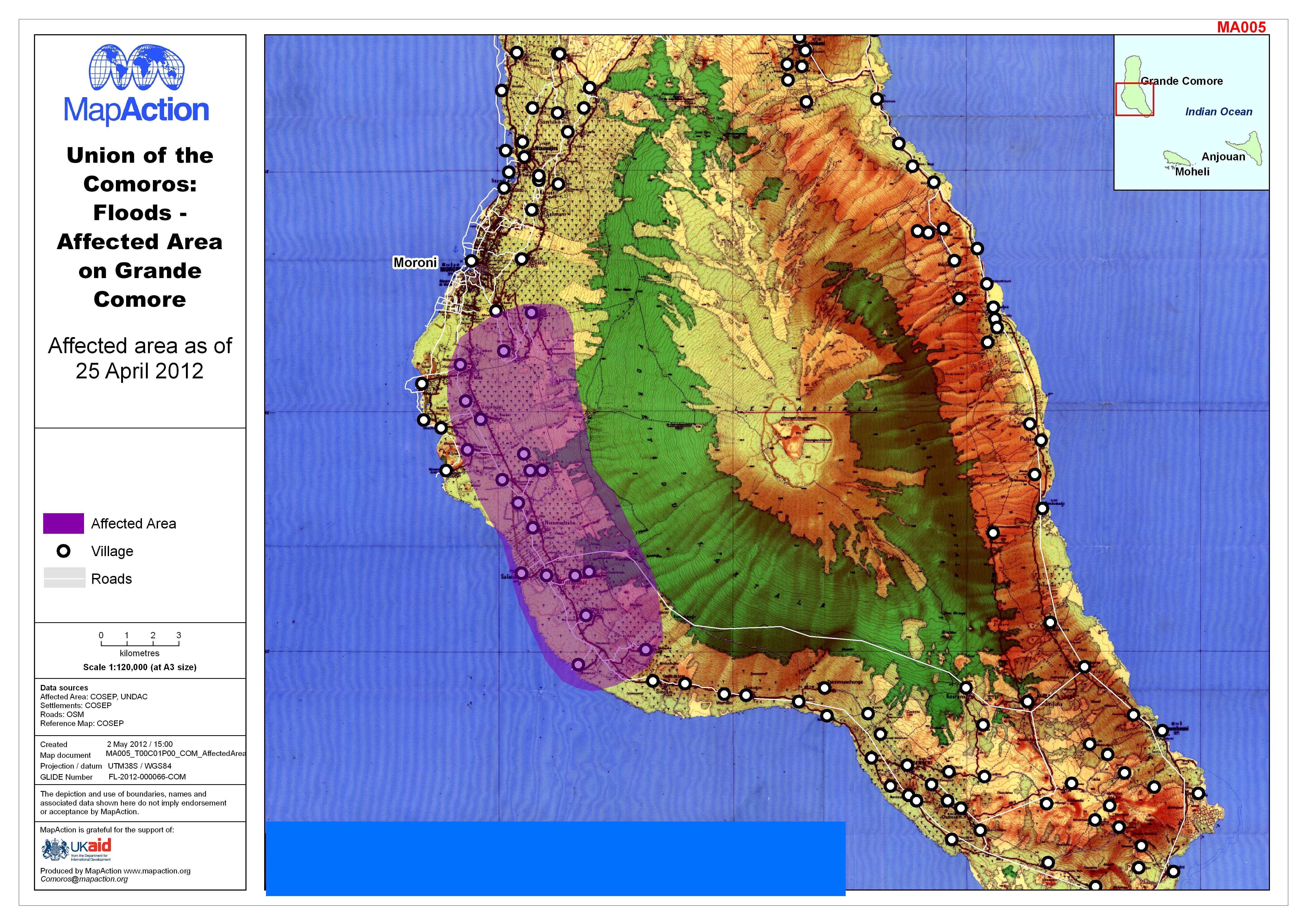
Map shows area affected by flooding on Grande Comore, as of 25 April 2012
Source: Union of the Comoros: Floods - Affected Area on Grande Comore
Additional Information
| Field | Value |
|---|---|
| Data last updated | July 4, 2016 |
| Metadata last updated | July 4, 2016 |
| Created | July 4, 2016 |
| Format | JPEG |
| License | License not specified |
| Has views | True |
| Id | da2447f4-8463-4508-a45e-905108cd20be |
| On same domain | True |
| Package id | 357e972e-cd11-4ee2-8963-4368d284ffa6 |
| Revision id | 8810d338-fd2f-48a3-b72a-80082b2eef70 |
| State | active |
| Url type | upload |