MA027_Brazzaville_Building_Assessment_v1-300dpi ...
From the dataset abstract
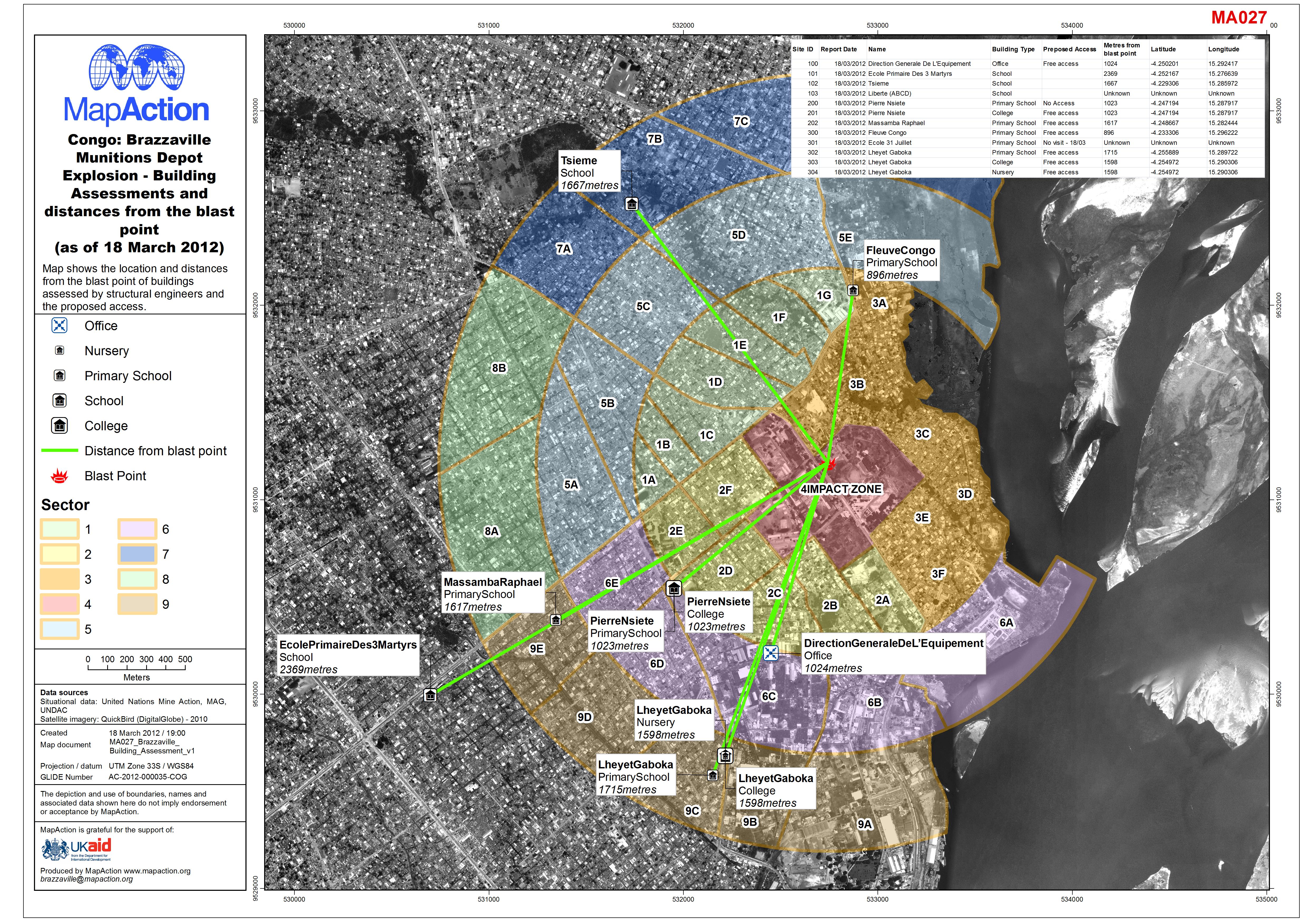
Map shows the location and distances from the blast point of buildings assessed by structural engineers and the proposed access.
Additional Information
| Field | Value |
|---|---|
| Data last updated | July 4, 2016 |
| Metadata last updated | July 4, 2016 |
| Created | July 4, 2016 |
| Format | JPEG |
| License | License not specified |
| Has views | True |
| Id | 58b8be1f-75ef-4bc2-8206-ec828db1e6e4 |
| On same domain | True |
| Package id | 3ada3945-7b6a-4f6a-9305-122cbcb9d5be |
| Revision id | 99bb32be-92b5-498d-bd03-671de8952926 |
| State | active |
| Url type | upload |