MA007_Brazzaville_Redzone_Checkpoint_v2.jpg
From the dataset abstract
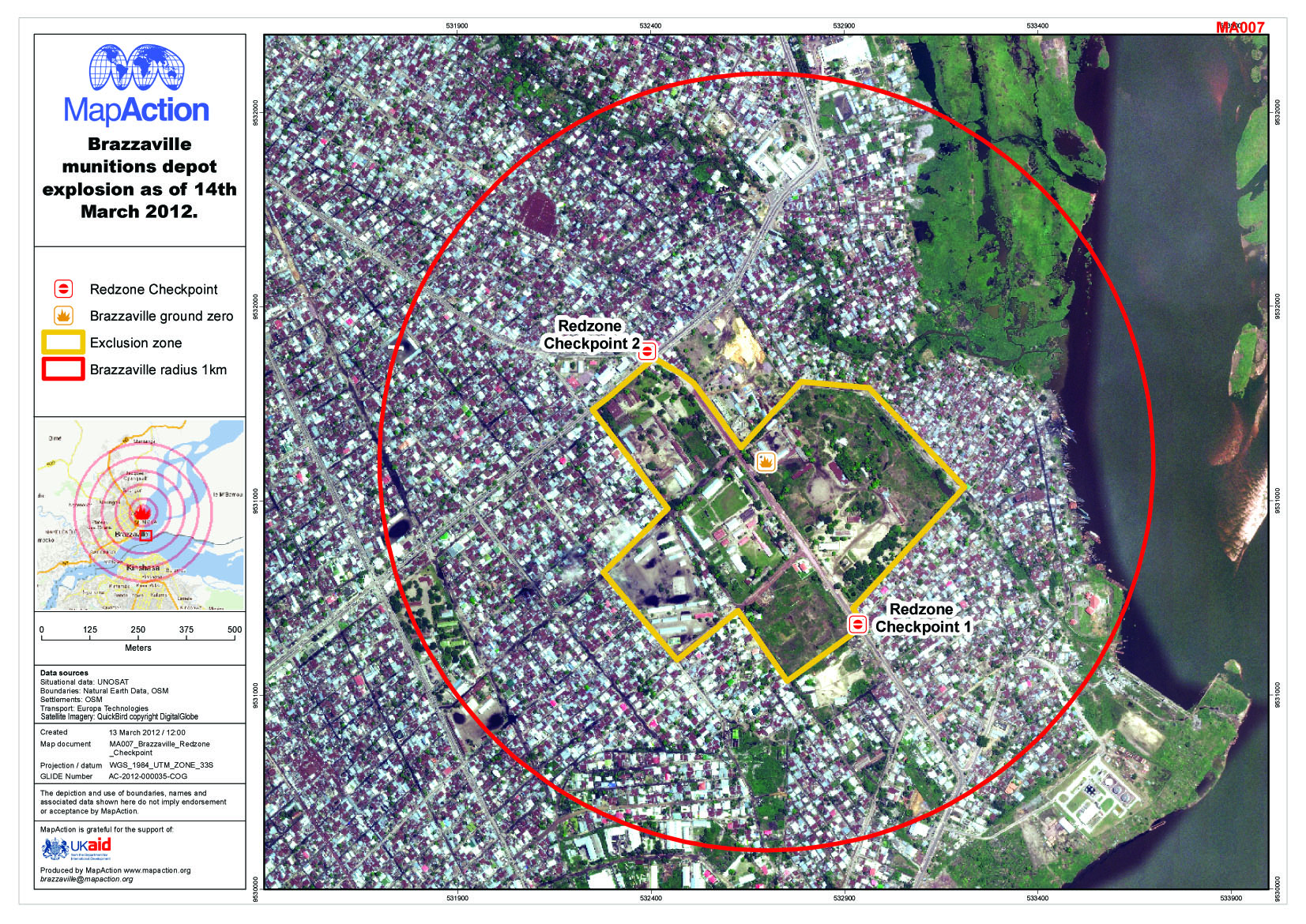
Map shows the extent of the exclusion zone, the redzone checkpoint and 1km radius from ground zero.
Source: Brazzaville munitions depot explosion as of 14th March 2012
Additional Information
| Field | Value |
|---|---|
| Data last updated | July 4, 2016 |
| Metadata last updated | July 4, 2016 |
| Created | July 4, 2016 |
| Format | JPEG |
| License | License not specified |
| Has views | True |
| Id | a6e7f394-2bfe-4d66-ae90-8c405e368c7f |
| On same domain | True |
| Package id | 819559eb-4d3a-4ae7-abfc-7a7a7e07c68a |
| Revision id | e7bf9326-7df8-4d8e-aba2-52ba25c722bb |
| State | active |
| Url type | upload |