thumbnail.png
From the dataset abstract
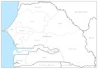
Editable PowerPoint maps illustrating level 1 administrative boundaries - click link to download - PPT002 Sahel Crisis: PowerPoint Map - Senegal
Additional Information
| Field | Value |
|---|---|
| Data last updated | July 28, 2016 |
| Metadata last updated | July 28, 2016 |
| Created | July 28, 2016 |
| Format | PNG |
| License | License not specified |
| Has views | True |
| Id | 7c337070-4e95-450c-852c-a294583310f4 |
| On same domain | True |
| Package id | c3d18d78-a66d-4205-890e-02a65d8a1c4a |
| Position | 3 |
| Revision id | f664de99-93c5-48fb-8d27-e6d1f23268f7 |
| State | active |
| Url type | upload |