thumbnail.png
From the dataset abstract
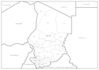
Editable PowerPoint maps illustrating level 1 administrative boundaries - click link to download - PPT002 Sahel Crisis: PowerPoint Map - Chad
Additional Information
| Field | Value |
|---|---|
| Data last updated | July 28, 2016 |
| Metadata last updated | July 28, 2016 |
| Created | July 28, 2016 |
| Format | PNG |
| License | License not specified |
| Has views | True |
| Id | f185e2c5-0f4c-4ec6-9733-37bba2f8c314 |
| On same domain | True |
| Package id | dec317eb-c56d-404e-8f63-c9cff6ade57d |
| Position | 3 |
| Revision id | 12664424-7b94-4ef7-ab42-67bf06c16f66 |
| State | active |
| Url type | upload |