thumbnail.png
From the dataset abstract
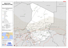
Reference map illustrating administrative boundaries, transport infrastructure and settlements.
Source: Sahel Crisis: Chad Reference Map
Additional Information
| Field | Value |
|---|---|
| Data last updated | July 28, 2016 |
| Metadata last updated | July 28, 2016 |
| Created | July 28, 2016 |
| Format | PNG |
| License | License not specified |
| Has views | True |
| Id | 7ed55024-3902-4c1f-a2b1-3d089226db96 |
| On same domain | True |
| Package id | 39ace441-546e-403a-8dfd-d1f852eab009 |
| Position | 2 |
| Revision id | 7683ac5f-24cf-48c5-af6e-fc848717ddfc |
| State | active |
| Url type | upload |