thumbnail.png
From the dataset abstract
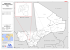
Reference map illustrating level 1 and level 2 administrative boundaries.
Additional Information
| Field | Value |
|---|---|
| Data last updated | July 28, 2016 |
| Metadata last updated | July 28, 2016 |
| Created | July 28, 2016 |
| Format | PNG |
| License | License not specified |
| Has views | True |
| Id | 868d7d26-9b9d-4166-b845-8f577f88664e |
| On same domain | True |
| Package id | 303fbec3-f491-43fb-8f07-790d320747f8 |
| Position | 1 |
| Revision id | 545d8861-457f-441e-b2d8-ea0cd8a5b3d4 |
| State | active |
| Url type | upload |