MA038_PHL_PopDensCDO_A3_v2-300dpi.jpg
From the dataset abstract
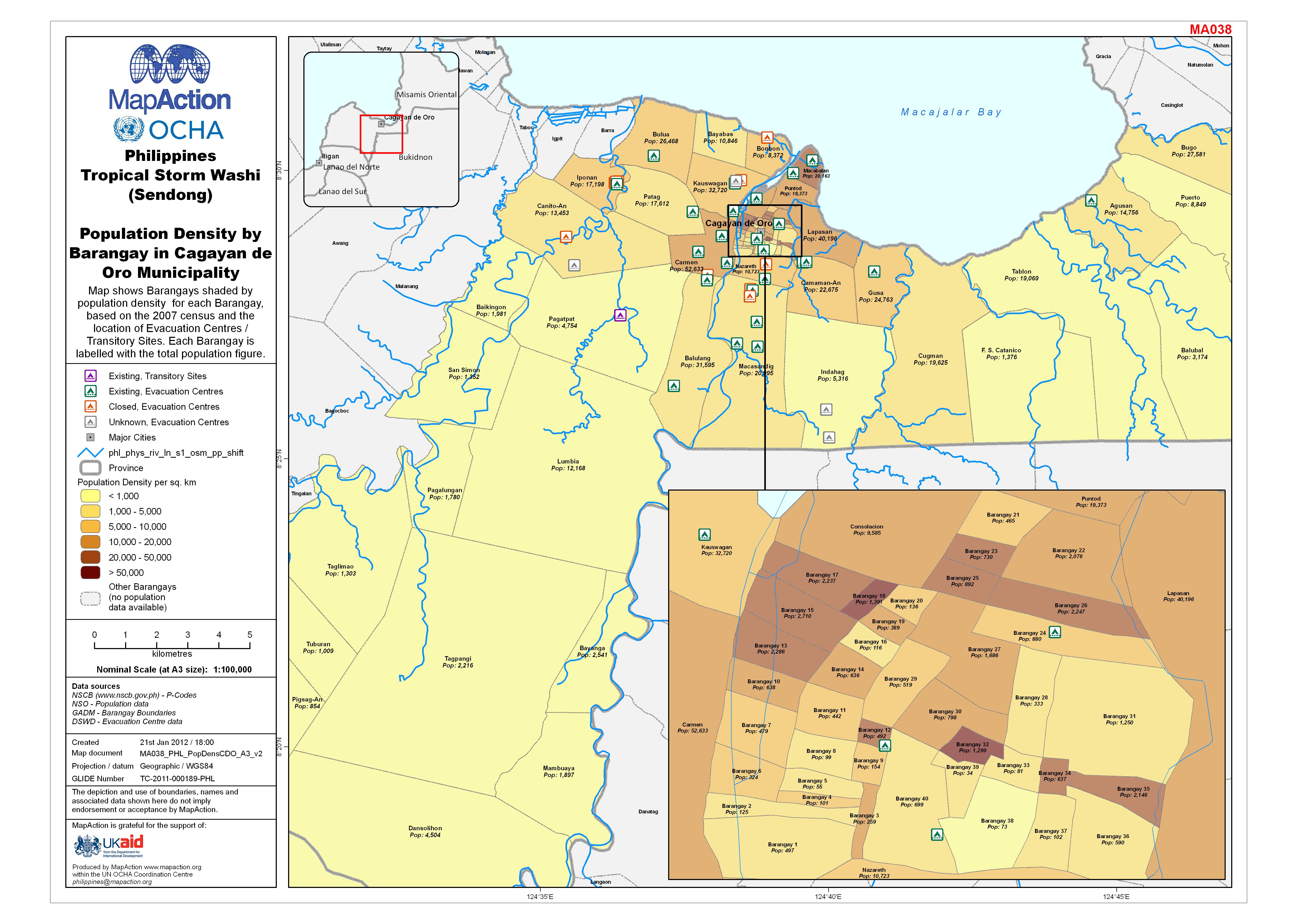
Map shows Barangays shaded by population density for each Barangay, based on the 2007 census and the location of Evacuation Centres / Transitory Sites. Each Barangay is labelled with the...
Additional Information
| Field | Value |
|---|---|
| Data last updated | July 4, 2016 |
| Metadata last updated | July 4, 2016 |
| Created | July 4, 2016 |
| Format | JPEG |
| License | License not specified |
| Has views | True |
| Id | fc4cc7ea-a16f-47f4-af8c-de1447b601be |
| On same domain | True |
| Package id | 30fa0194-3b8b-4d12-a2c7-4f25d6c130f3 |
| Revision id | 6c8cbd26-ea9f-4926-bf11-030f5d44c86a |
| State | active |
| Url type | upload |