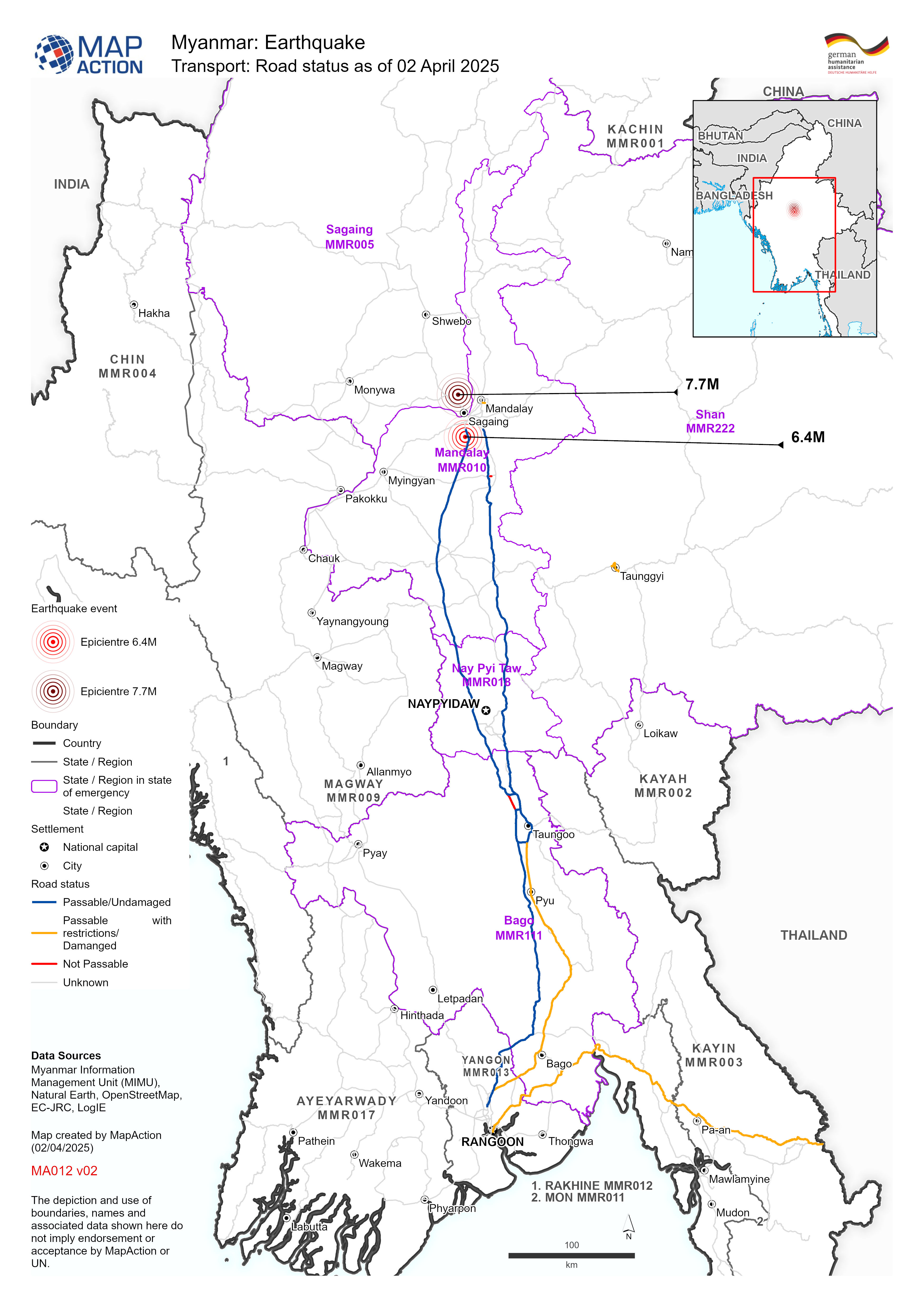
MA012-v02-mmr-affected_infra_roads-300dpi.jpg
From the dataset abstract
Map shows the road status (as of 02 April 2025) with earthquake epicentres and affected State - Regions of Myanmar.
Additional Information
| Field | Value |
|---|---|
| Data last updated | April 2, 2025 |
| Metadata last updated | April 2, 2025 |
| Created | April 2, 2025 |
| Format | JPEG |
| License | License not specified |
| Has views | True |
| Id | 00a6362f-5a54-4276-883c-aa8852890cb2 |
| Mimetype | image/jpeg |
| On same domain | True |
| Package id | f79f32cc-fc50-4520-9a61-fb699ec04122 |
| Position | 1 |
| Revision id | ede269ae-a10c-41a2-a3c8-60077204cd3a |
| Size | 1.5 MiB |
| State | active |
| Url type | upload |
