thumbnail.png
From the dataset abstract
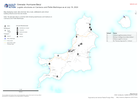
Map displaying roads, ferry terminal, ferry route, settlements and critical building infrastructure that are known. Note: No granular data is currently held showing warehouses and...
Source: Logistic structures on Carriacou and Petite Martinique as at July 19, 2024
Additional Information
| Field | Value |
|---|---|
| Data last updated | July 20, 2024 |
| Metadata last updated | July 20, 2024 |
| Created | July 20, 2024 |
| Format | PNG |
| License | License not specified |
| Has views | True |
| Id | 6eea6e4e-248a-4f65-bace-f5f8914f2a62 |
| Mimetype | image/png |
| On same domain | True |
| Package id | 0829b070-b68e-4900-a69a-579d031ab3c2 |
| Position | 2 |
| Revision id | 7d20bc18-c2fc-4c0e-9d5f-daef332a6847 |
| Size | 10.4 KiB |
| State | active |
| Url type | upload |