thumbnail.png
From the dataset abstract
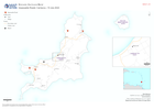
Map displaying key infrastructure and impassable roads from field observations
Additional Information
| Field | Value |
|---|---|
| Data last updated | July 10, 2024 |
| Metadata last updated | July 10, 2024 |
| Created | July 10, 2024 |
| Format | PNG |
| License | License not specified |
| Has views | True |
| Id | 9faf2255-fbe8-46aa-96f7-c0092c85bc31 |
| Mimetype | image/png |
| On same domain | True |
| Package id | 4c42d698-8225-4442-9d0b-3f5f62d4a7c9 |
| Position | 2 |
| Revision id | f4509a4f-463b-4890-ae30-98683c3aa207 |
| Size | 9.7 KiB |
| State | active |
| Url type | upload |