MA021_Impassable_Roads_Carriacou-300dpi.jpg
From the dataset abstract
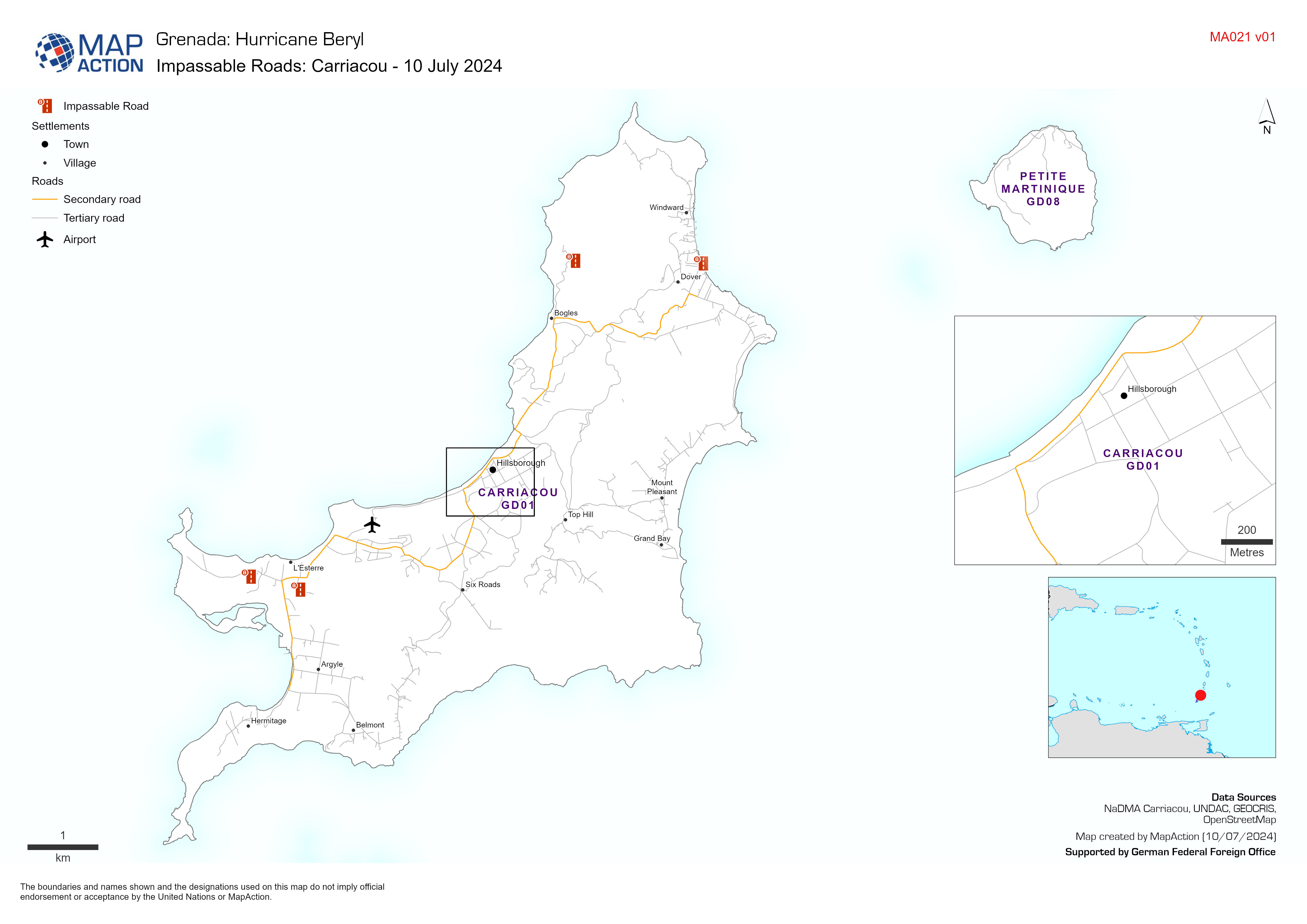
Map displaying key infrastructure and impassable roads from field observations
Additional Information
| Field | Value |
|---|---|
| Data last updated | July 10, 2024 |
| Metadata last updated | July 10, 2024 |
| Created | July 10, 2024 |
| Format | JPEG |
| License | License not specified |
| Has views | True |
| Id | 5dfc1aae-5ced-42a3-b837-1e3d8479637c |
| Mimetype | image/jpeg |
| On same domain | True |
| Package id | 4c42d698-8225-4442-9d0b-3f5f62d4a7c9 |
| Position | 1 |
| Revision id | be7986f3-d893-4ab7-a094-302b4a540132 |
| Size | 924.4 KiB |
| State | active |
| Url type | upload |