MA008-v01-mdg-overview-atlas-admin1-300dpi.jpg
From the dataset abstract
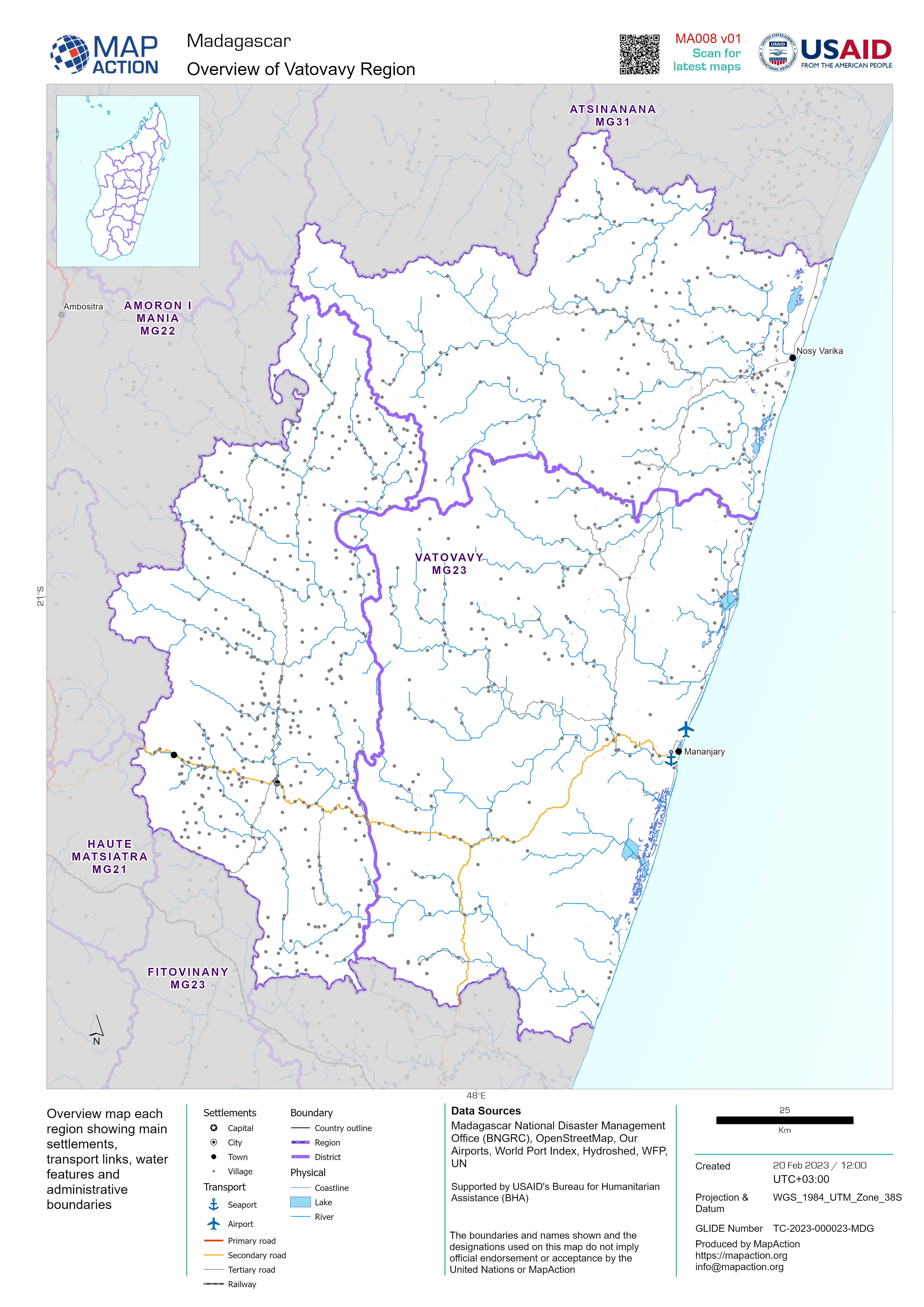
Overview map each region showing main settlements, transport links, water features and administrative boundaries
Additional Information
| Field | Value |
|---|---|
| Data last updated | February 22, 2023 |
| Metadata last updated | February 22, 2023 |
| Created | February 22, 2023 |
| Format | JPEG |
| License | License not specified |
| Has views | True |
| Id | 91d09330-770a-4f88-aeb7-e0fda59b2988 |
| Mimetype | image/jpeg |
| On same domain | True |
| Package id | f36862ab-083c-465f-a0e9-28e65f33d81e |
| Revision id | 23e6736e-41be-4dec-ab03-d37ff2cf8050 |
| Size | 1.6 MiB |
| State | active |
| Url type | upload |