MA001-v01-pry-country-overview-300dpi.jpg
From the dataset abstract
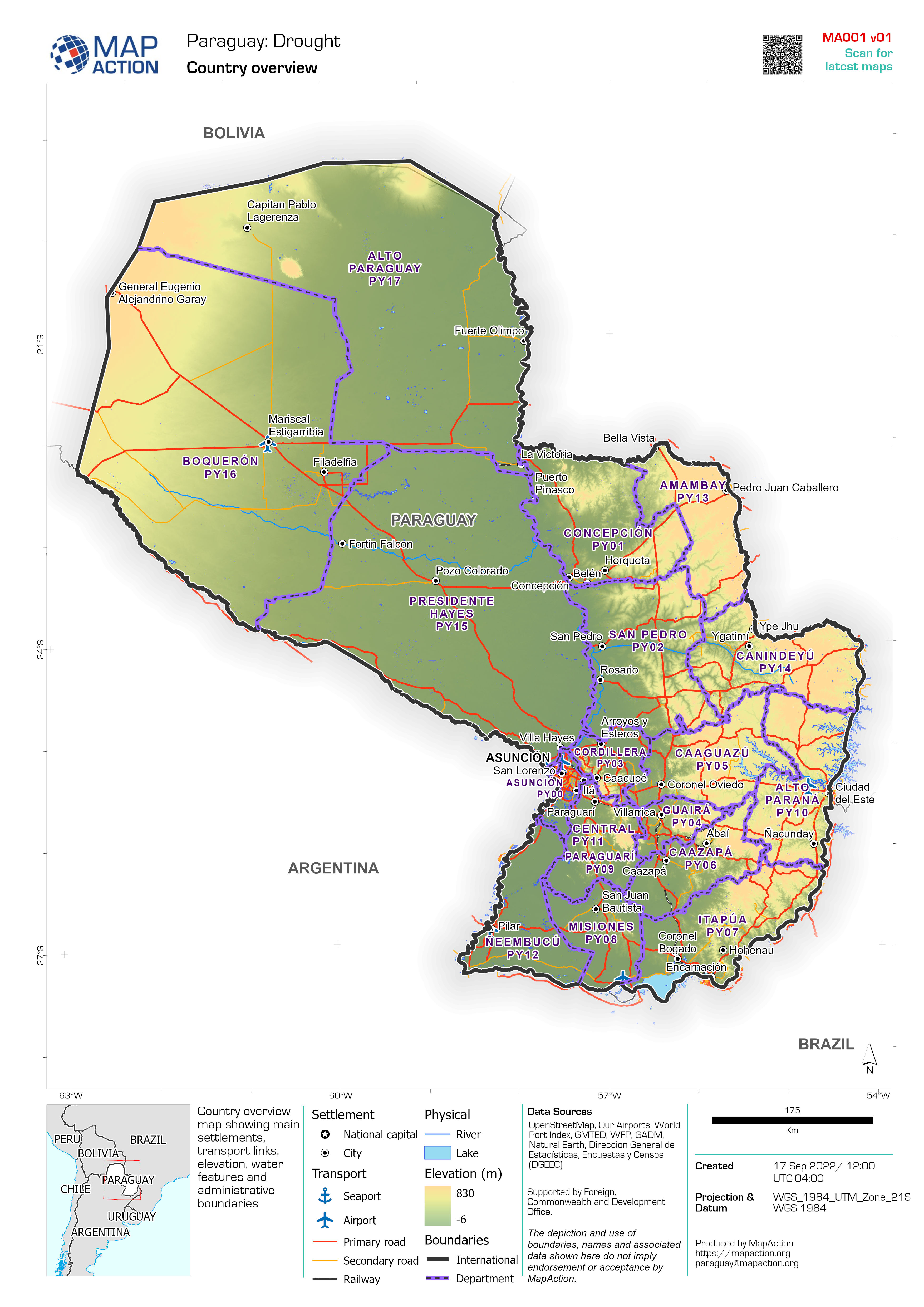
Country overview map showing main settlements, transport links, elevation, water features and administrative boundaries
Source: Country overview
Additional Information
| Field | Value |
|---|---|
| Data last updated | September 17, 2022 |
| Metadata last updated | September 17, 2022 |
| Created | September 17, 2022 |
| Format | JPEG |
| License | License not specified |
| Has views | True |
| Id | 8493f46a-5e91-4f03-8f7f-34bd27b6d257 |
| Mimetype | image/jpeg |
| On same domain | True |
| Package id | b1d84e60-cb7d-467b-b5ab-ccea63a2886b |
| Position | 1 |
| Revision id | 4a63d65d-be9d-4f8c-b211-fd0b924067a4 |
| Size | 1.8 MiB |
| State | active |
| Url type | upload |