MA015-v03-gmb-situational-map-landscape-300dpi.jpg
From the dataset abstract
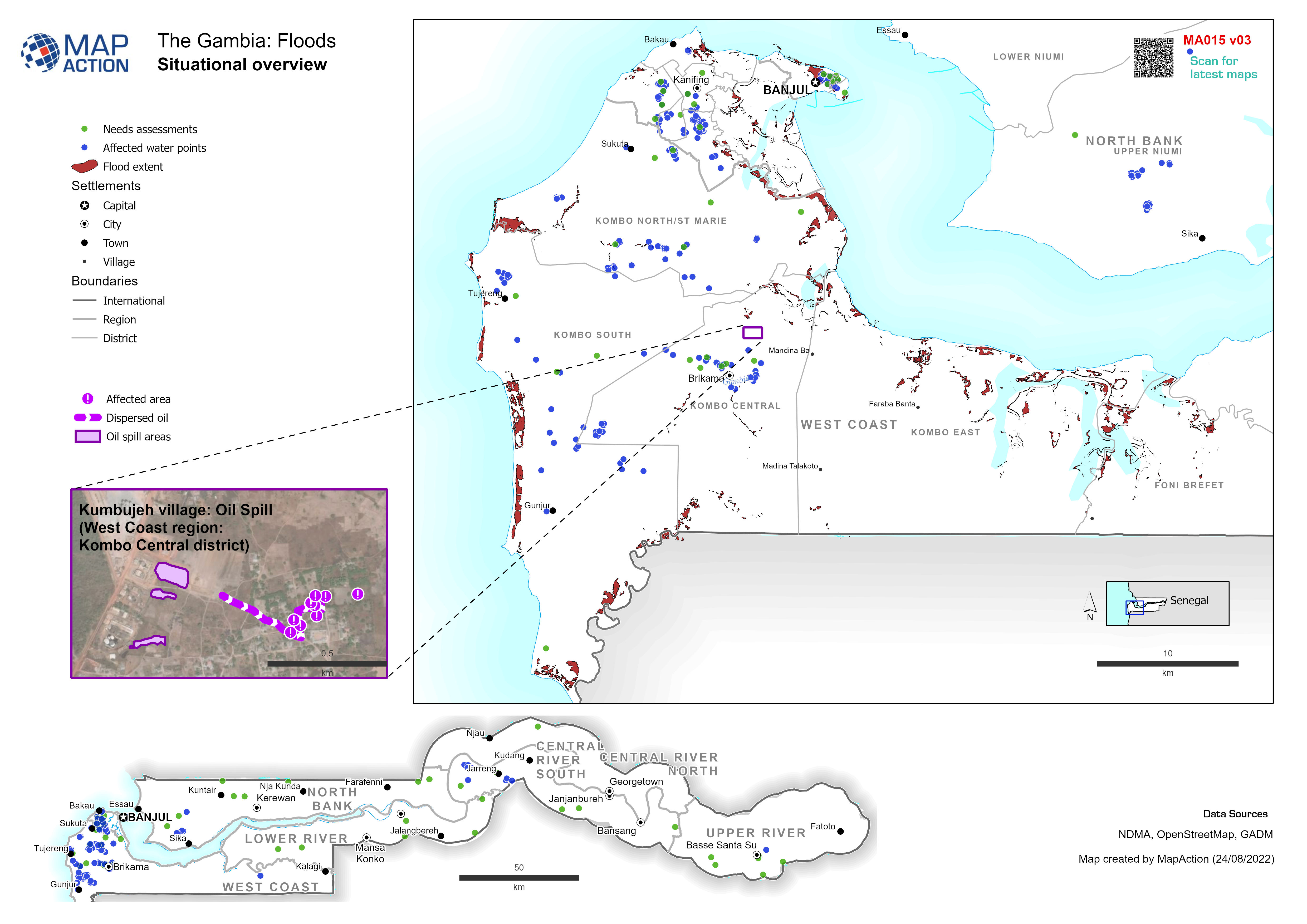
Example: Map shows the extent of known flooding from satellite images on 1 Jan 2012.
Source: Situational overview
Additional Information
| Field | Value |
|---|---|
| Data last updated | August 24, 2022 |
| Metadata last updated | August 24, 2022 |
| Created | August 24, 2022 |
| Format | JPEG |
| License | License not specified |
| Has views | True |
| Id | 05ac9d93-6fc6-4443-8cd8-25d3eb2361b6 |
| Mimetype | image/jpeg |
| On same domain | True |
| Package id | 393476d3-6479-4b21-aed5-498546f3450e |
| Position | 1 |
| Revision id | dc9b7cfb-8811-408a-85ae-1ab155836aa6 |
| Size | 1.3 MiB |
| State | active |
| Url type | upload |