thumbnail.png
From the dataset abstract
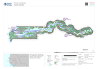
Country overview map showing main settlements, transport links, elevation, water features and administrative boundaries
Source: Country overview
Additional Information
| Field | Value |
|---|---|
| Data last updated | August 23, 2022 |
| Metadata last updated | August 23, 2022 |
| Created | August 23, 2022 |
| Format | PNG |
| License | License not specified |
| Has views | True |
| Id | 4c56e274-8911-4a81-b8bb-7e04b04eaf8c |
| Mimetype | image/png |
| On same domain | True |
| Package id | 31f4a94b-0588-4b1d-a99e-dafc11b6f4e4 |
| Position | 2 |
| Revision id | e0d62b9e-ec27-4c7a-af67-f93f6b43825d |
| Size | 11.8 KiB |
| State | active |
| Url type | upload |