MA019-v01-vct-Risk_Mapping-modelling-300dpi.jpeg
From the dataset abstract
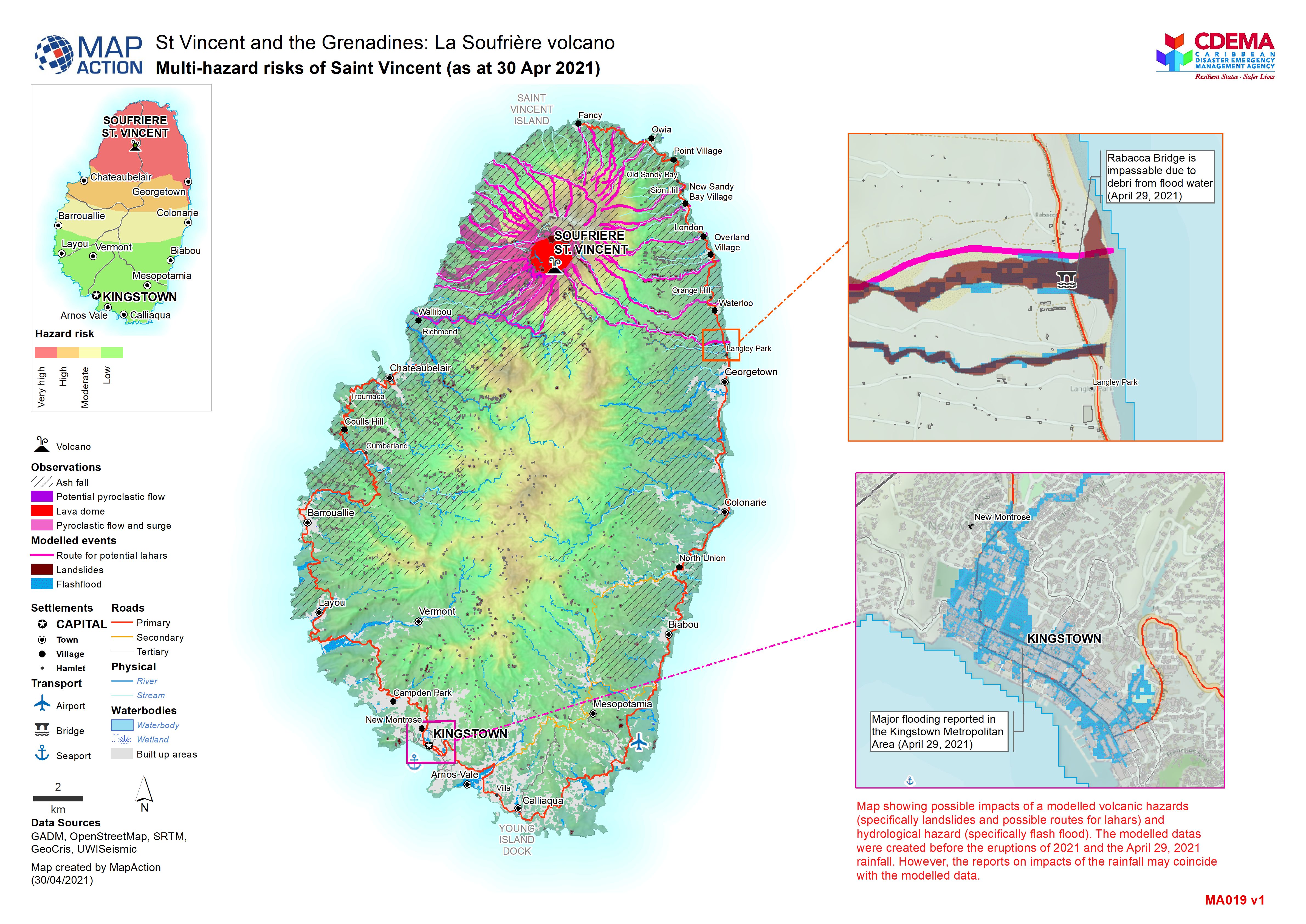
Map showing possible impacts of a modelled volcanic hazards (specifically landslides and possible routes for lahars) and hydrological hazard (specifically flash flood). The modelled datas...
Source: Multi-hazard risks of Saint Vincent (as at 30 Apr 2021)
Additional Information
| Field | Value |
|---|---|
| Data last updated | May 4, 2021 |
| Metadata last updated | May 4, 2021 |
| Created | May 4, 2021 |
| Format | JPEG |
| License | License not specified |
| Has views | True |
| Id | 2d56ef7f-9970-4006-a375-526dd1d990b4 |
| Mimetype | image/jpeg |
| On same domain | True |
| Package id | a025155e-3027-4724-a315-5ef9182a285b |
| Revision id | 7ee18695-3153-4c14-bc5c-e3b2b323f83a |
| Size | 1.8 MiB |
| State | active |
| Url type | upload |