MA010-v01-vct-land-use-300dpi.jpeg
From the dataset abstract
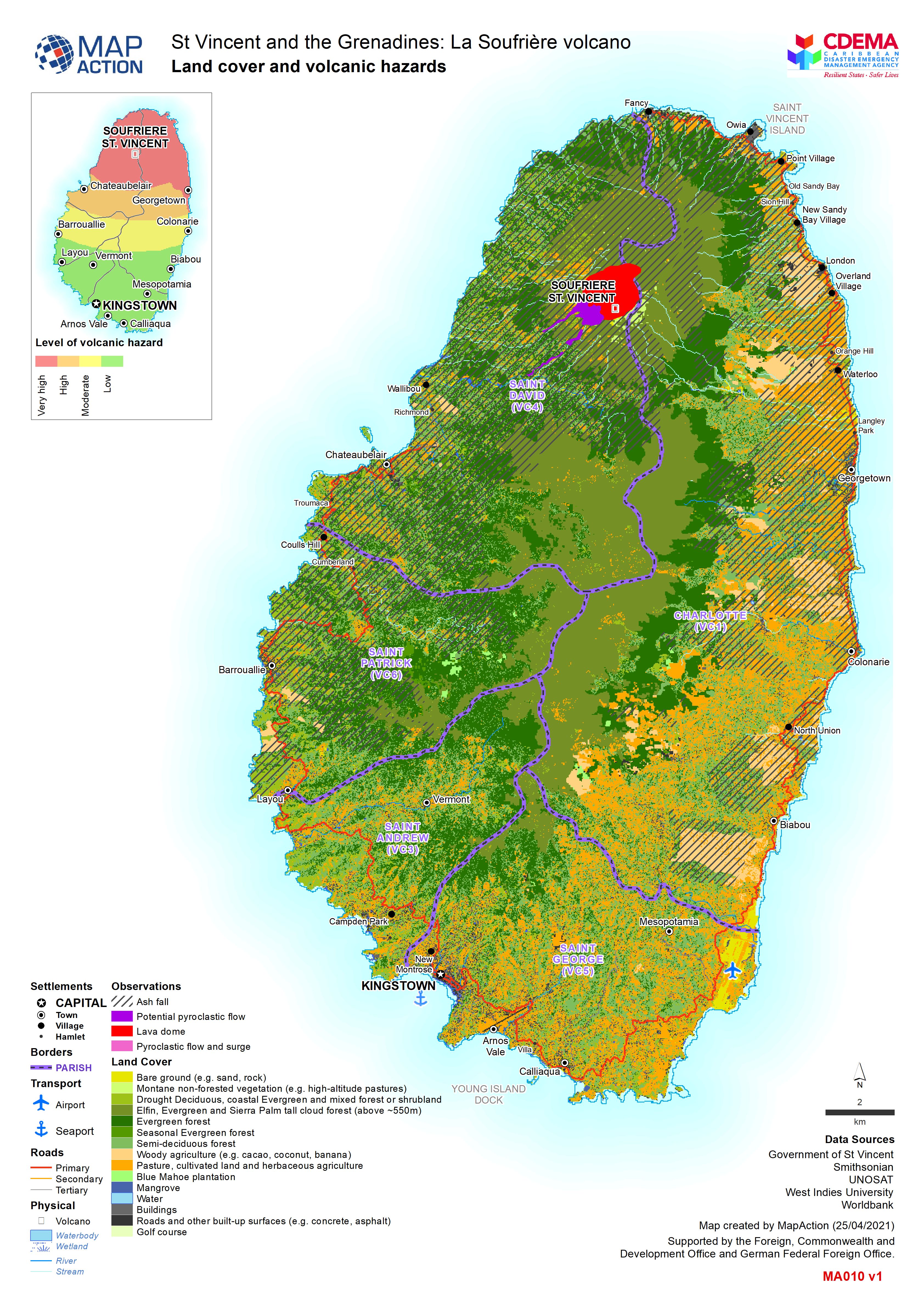
Map shows landuse in Saint Vincent and the extent of the ash from the La Soufrière eruptions.
Source: Land cover and volcanic hazards
Additional Information
| Field | Value |
|---|---|
| Data last updated | April 28, 2021 |
| Metadata last updated | April 28, 2021 |
| Created | April 28, 2021 |
| Format | JPEG |
| License | License not specified |
| Has views | True |
| Id | f3bbbff4-80ad-45c3-bb45-e3effe2f8abf |
| Mimetype | image/jpeg |
| On same domain | True |
| Package id | a6c40581-3ab0-4665-b327-9052e945a721 |
| Revision id | 0098a6e5-ff18-4c2d-b813-6a20abf99f4d |
| Size | 2.6 MiB |
| State | active |
| Url type | upload |