ma014_ken_ahn_assm_conflict_a3.jpg
From the dataset abstract
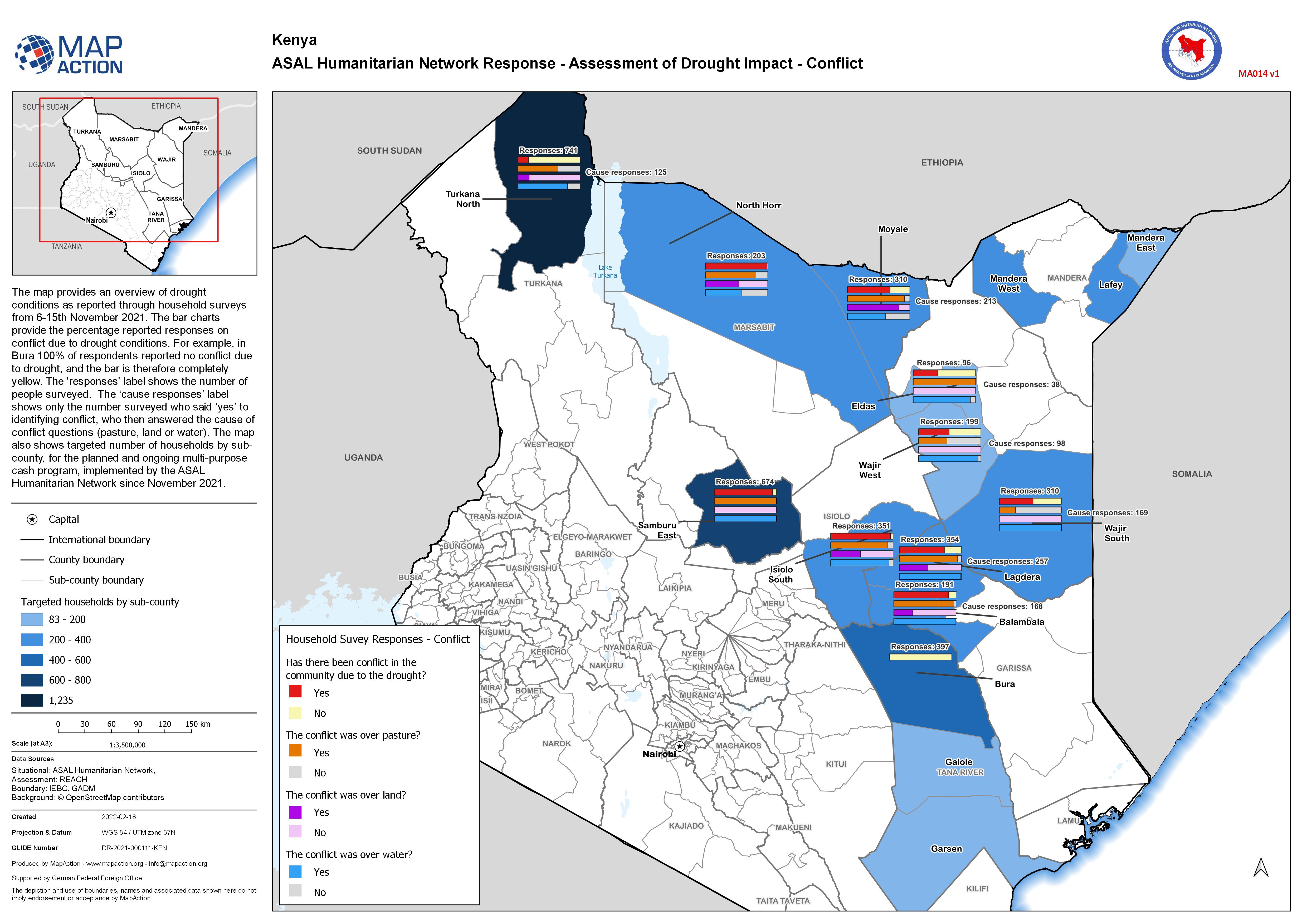
The map provides an overview of drought conditions as reported through household surveys from 6-15th November 2021. The bar charts provide the percentage reported responses on conflict...
Source: ASAL Humanitarian Network Response - Assessment of Drought Impact - Conflict
Additional Information
| Field | Value |
|---|---|
| Data last updated | February 19, 2022 |
| Metadata last updated | February 19, 2022 |
| Created | February 19, 2022 |
| Format | JPEG |
| License | License not specified |
| Has views | True |
| Id | 0efded0b-b55a-47f8-89a7-1784edd3405e |
| Mimetype | image/jpeg |
| On same domain | True |
| Package id | 5a430f69-b0d9-4836-ab40-7e887d2190dd |
| Position | 1 |
| Revision id | 65518aad-e9b1-478a-acea-342c399009b9 |
| Size | 1.2 MiB |
| State | active |
| Url type | upload |