ma005_ken_ahn_hh_adm1_atlas_08_Wajir.jpg
From the dataset abstract
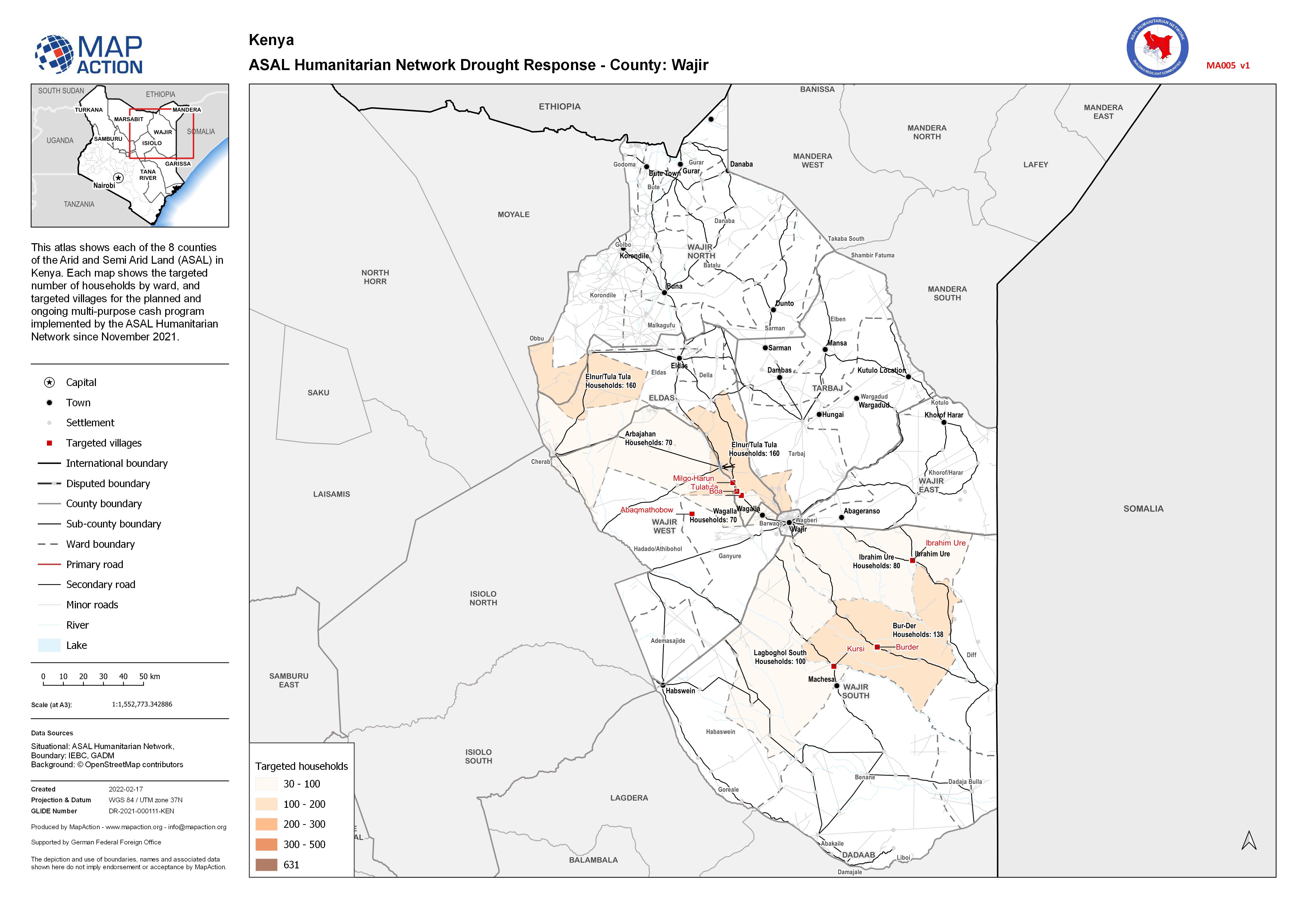
This atlas shows each of the 8 counties of the Arid and Semi Arid Land (ASAL) in Kenya. Each map shows the targeted number of households by ward, and targeted villages for the planned and...
Additional Information
| Field | Value |
|---|---|
| Data last updated | February 19, 2022 |
| Metadata last updated | February 19, 2022 |
| Created | February 19, 2022 |
| Format | JPEG |
| License | License not specified |
| Has views | True |
| Id | 0606fd9d-7599-4ee1-a138-817ff4284bc4 |
| Mimetype | image/jpeg |
| On same domain | True |
| Package id | 90ace9ba-4392-4563-b38e-32015bf343a4 |
| Position | 16 |
| Revision id | 6656f3c9-bdd2-4e40-b056-9c5e4ff24733 |
| Size | 1 MiB |
| State | active |
| Url type | upload |