thumbnail.png
From the dataset abstract
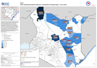
The map provides an overview of drought and crop conditions as reported through household surveys from 6-15th November 2021. The bar charts provide the percentage reported responses on...
Source: ASAL Humanitarian Network Response - Assessment of Drought Impact - Crop Losses
Additional Information
| Field | Value |
|---|---|
| Data last updated | February 19, 2022 |
| Metadata last updated | February 19, 2022 |
| Created | February 19, 2022 |
| Format | PNG |
| License | License not specified |
| Has views | True |
| Id | f403e1b9-1db6-4e25-9c2a-d4d82750f82e |
| Mimetype | image/png |
| On same domain | True |
| Package id | d4d628af-eba5-4d02-b44a-77b889a9a196 |
| Position | 2 |
| Revision id | a9420b64-5c6f-40be-9984-7c6ea1600bf7 |
| Size | 16.6 KiB |
| State | active |
| Url type | upload |