ma011_ken_ahn_drought_overview.jpg
From the dataset abstract
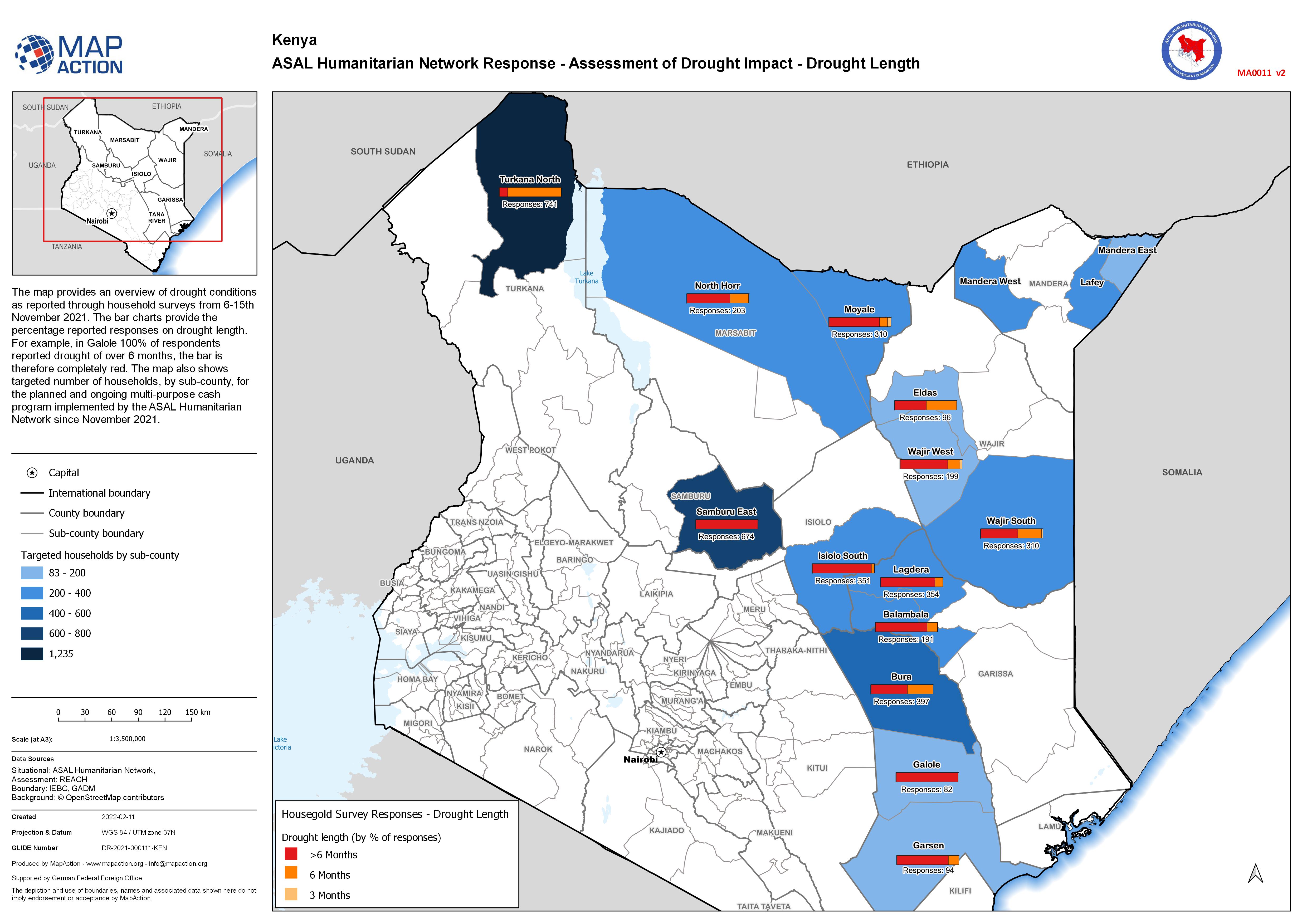
The map provides an overview of drought conditions as reported through household surveys from 6-15th November 2021. The bar charts provide the percentage reported responses on drought...
Source: ASAL Humanitarian Network Response - Assessment of Drought Impact - Drought Length
Additional Information
| Field | Value |
|---|---|
| Data last updated | February 19, 2022 |
| Metadata last updated | February 19, 2022 |
| Created | February 19, 2022 |
| Format | JPEG |
| License | License not specified |
| Has views | True |
| Id | d2709a07-01b7-4c73-9ebd-4d5564bd2333 |
| Mimetype | image/jpeg |
| On same domain | True |
| Package id | 9c4c7902-1946-4676-b586-6a237fda94c2 |
| Position | 1 |
| Revision id | ca3bfa89-acbf-44c5-9376-0973c0bf2219 |
| Size | 1.1 MiB |
| State | active |
| Url type | upload |