MA012 - Shelter Location and Status ...
From the dataset abstract
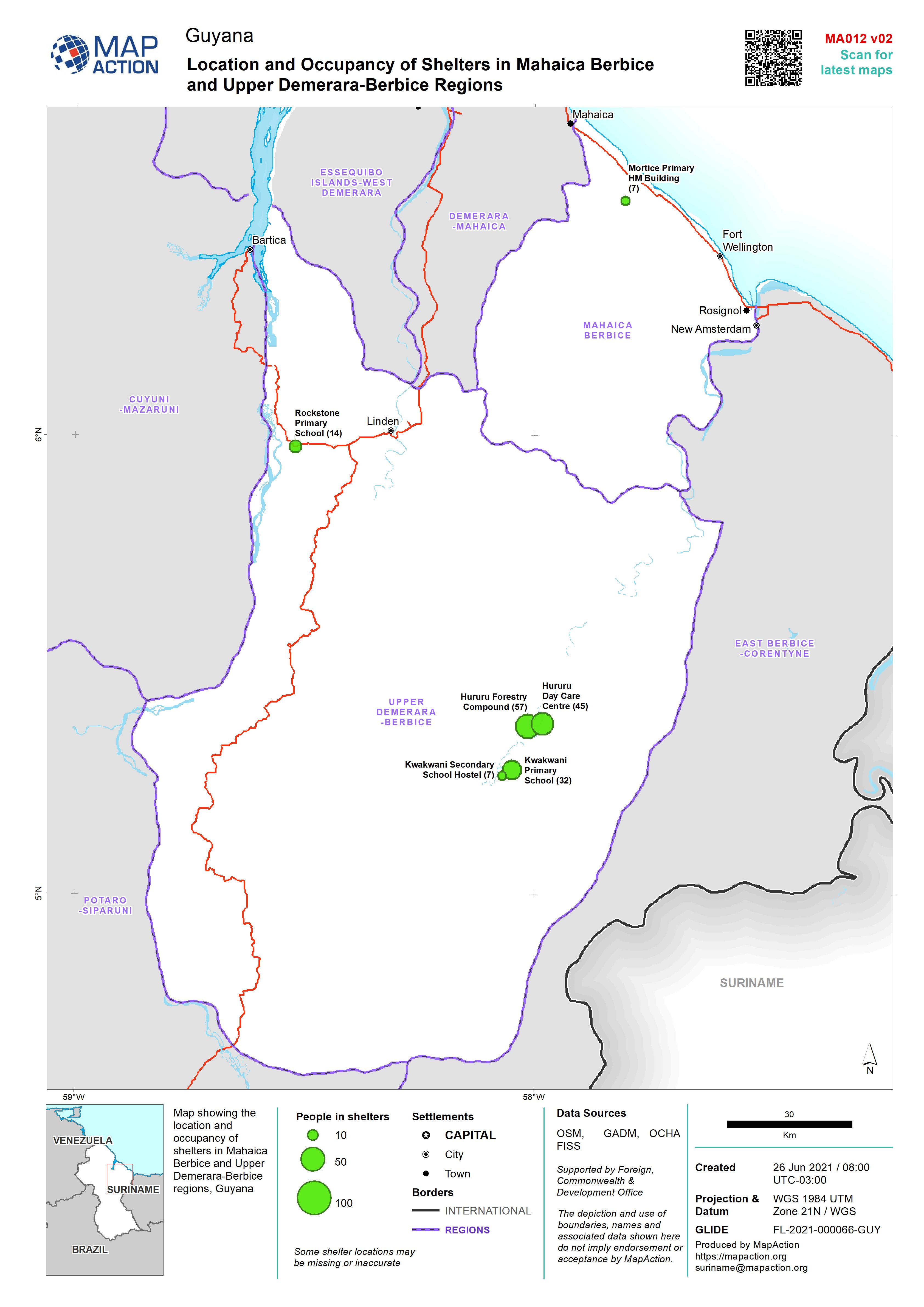
Map showing the location and occupancy of shelters in Mahaica Berbice and Upper Demerara-Berbice regions, Guyana
Source: Location and Occupancy of Shelters in Mahaica Berbice and Upper Demerara-Berbice Regions
Additional Information
| Field | Value |
|---|---|
| Data last updated | June 26, 2021 |
| Metadata last updated | June 26, 2021 |
| Created | June 26, 2021 |
| Format | JPEG |
| License | License not specified |
| Has views | True |
| Id | b29b338f-2f06-47be-bd5f-bb1531037026 |
| Mimetype | image/jpeg |
| On same domain | True |
| Package id | 63997ecf-c717-437d-9cd2-ec6b0f929f56 |
| Revision id | 6cf3b70c-5993-4ffb-91a2-99fcc224327e |
| Size | 953.1 KiB |
| State | active |
| Url type | upload |