thumbnail.png
From the dataset abstract
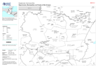
Map shows the Departments (Admin 1) and Municipalities (Admin 2) boundaries with Pcodes
Source: Guatemala: Admin and Pcode Atlas
Additional Information
| Field | Value |
|---|---|
| Data last updated | November 11, 2020 |
| Metadata last updated | November 11, 2020 |
| Created | November 11, 2020 |
| Format | PNG |
| License | License not specified |
| Has views | True |
| Id | 052af644-ea0f-4ad5-83de-c1068d6155ba |
| Mimetype | image/png |
| On same domain | True |
| Package id | 339445fd-83a5-4850-ba3d-d7b5eabfce85 |
| Position | 2 |
| Revision id | 25f97073-7e98-4242-8573-34988a873f8e |
| Size | 14.5 KiB |
| State | active |
| Url type | upload |