MA311_Guatemala_Population_At_Risk_v02-300dpi.jpeg
From the dataset abstract
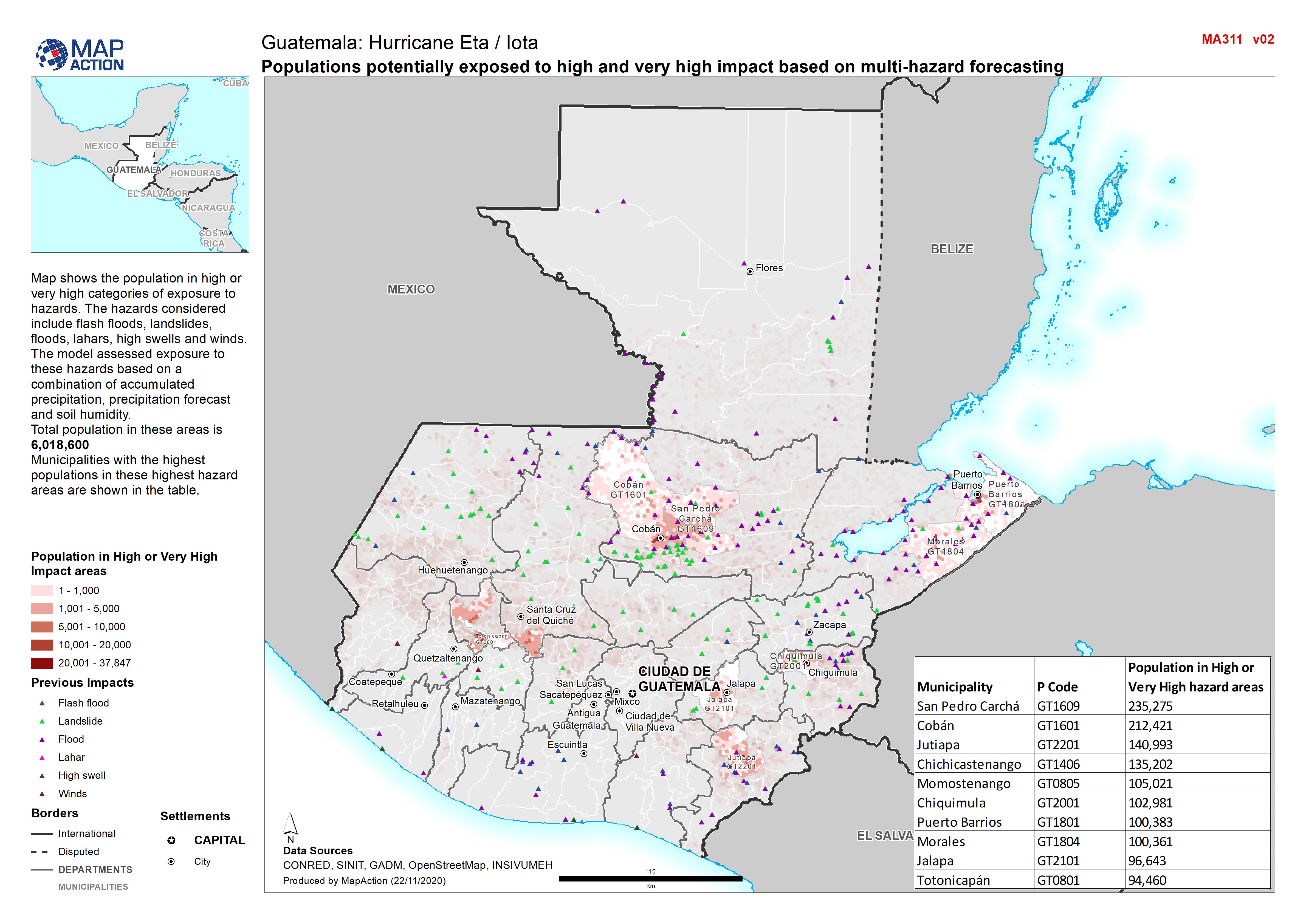
Map shows the population in high or very high categories of exposure to hazards. The hazards considered include flash floods, landslides, floods, lahars, high swells and winds. The model...
Additional Information
| Field | Value |
|---|---|
| Data last updated | November 27, 2020 |
| Metadata last updated | November 27, 2020 |
| Created | November 27, 2020 |
| Format | JPEG |
| License | License not specified |
| Has views | True |
| Id | a7109d39-302c-4fbf-8391-e342033b0474 |
| Mimetype | image/jpeg |
| On same domain | True |
| Package id | 53125b91-85cb-4b03-b7bc-0d2c10e94a24 |
| Revision id | 256a8ca8-a9ba-451d-913b-05259ae99d24 |
| Size | 1.3 MiB |
| State | active |
| Url type | upload |